Ancient Underwater Wall Found Off Croatia’s Coast
Something 1.4 kilometers long has been resting on the floor of the Adriatic, off the coast of Korčula, for roughly 8,000 years — and the ancient underwater wall sat there, utterly ignored, while every civilization we consider foundational rose, peaked, and collapsed above it. The sea keeps its secrets longer than we keep our assumptions.
A World Beneath the Waves
Eight thousand years ago, the Adriatic looked nothing like it does today. Sea levels during the Mesolithic were dramatically lower — in some regions by 100 meters or more — and the water now lapping above this wall would have been dry land. Fertile land, most likely. The kind of coastal plain where communities of hunter-gatherers learned the rhythms of the tides and, apparently, decided to start building things.
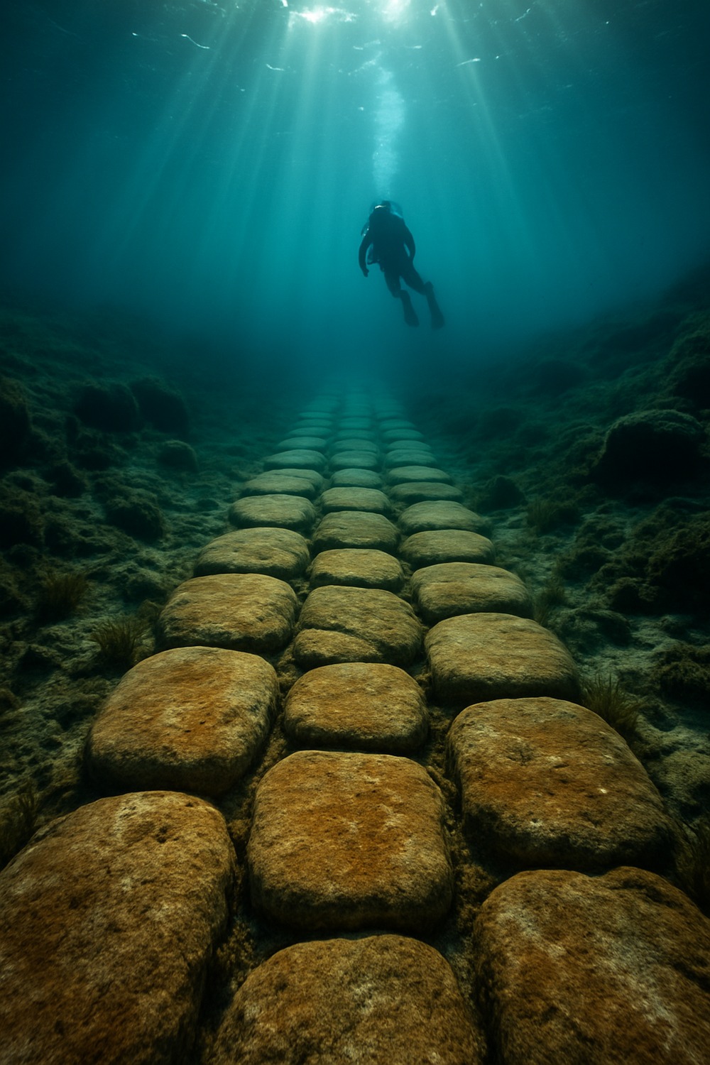
Archaeologists from the University of Zadar led the underwater investigations, deploying diving surveys, sonar mapping, and sediment analysis to trace the wall’s full extent. The stones run in a deliberate linear formation, averaging roughly five meters wide and preserved in sections to about one meter in height — consistent, arranged, unmistakably intentional. Radiocarbon dating of organic material from the surrounding sediment confirmed what the structure’s position in the landscape had already suggested: this belongs firmly to the Mesolithic, that long stretch of human prehistory running from approximately 10,000 to 5,000 years before the present. The sea rose, swallowed the plain, and — almost incidentally — became the best preservation system these builders could have hoped for.
Engineering Before History
Nobody agrees yet on what the wall was actually for, and the debate has a certain productive energy to it. One camp reads it as a causeway — a raised pathway linking higher ground across a shallow lagoon or wetland. Another sees an early fish weir, a barrier designed to manage tidal fish populations in ways that would constitute a remarkably sophisticated approach to resource management. A third interpretation places it as a rudimentary harbor feature, somewhere Mesolithic seafarers could moor simple watercraft and trade goods or information with neighboring groups. Each hypothesis holds together. None can be ruled out.
What all three share is the same uncomfortable implication: whoever built this wall wasn’t improvising. They were planning — coordinating labor across an extended project, engineering something nearly a mile and a half long, with some vision of long-term utility clearly in mind. That’s not the behavior we’ve traditionally mapped onto the word “Mesolithic.”
The ocean floor, it turns out, has been a better archivist than anything on dry land.
Korčula doesn’t stand alone in forcing this reassessment. Submerged landscapes off Britain, Scandinavia, the Persian Gulf, and Southeast Asia have all turned up evidence of pre-historical human activity — sites flooded by the same post-glacial sea rise that claimed this Croatian wall. Underwater archaeology is quietly dismantling the old story of primitive nomads scratching out an existence before the Neolithic arrived to civilize things. Erosion, agriculture, and millennia of human activity have long since erased comparable sites on dry land; beneath the water, the record remains.
Rewriting the Mesolithic Story
Why does this matter? Because the story we’ve told about the Mesolithic has always been more comfortable than accurate.
In the popular imagination, the Mesolithic is the awkward middle chapter — wedged between the drama of Paleolithic cave art and the apparent triumph of Neolithic farming, it tends to read as a waiting room. A transitional phase. The part of the story where nothing much happened yet. The Korčula wall makes that framing very difficult to sustain: here are people actively reshaping their landscape, coordinating large-scale construction, demonstrating a capacity for collective architectural thinking that we’d normally reserve for societies we consider far more “advanced.”
History has a way of treating the people who ignored this kind of evidence unkindly.
And the wall demands a harder look at what we mean when we use words like “civilization” — specifically, when we assume it starts. The Mesolithic wasn’t a waiting room. It was already something.
{{IMAGE_1}}
What Lies Hidden Still
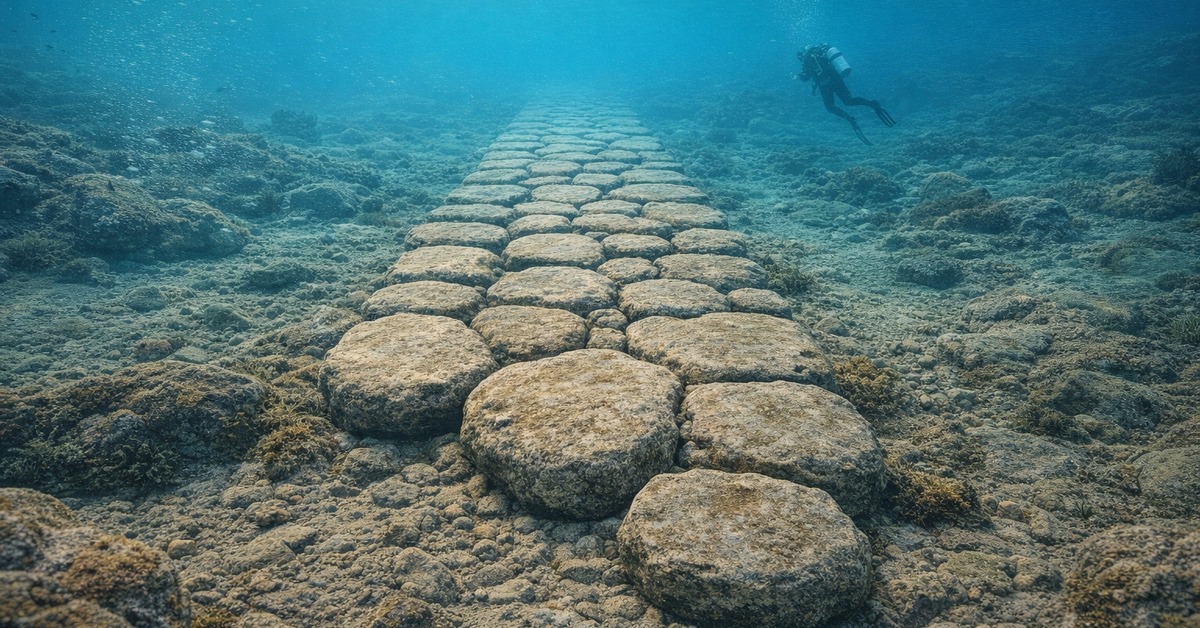
Researchers suspect the Adriatic may be unusually generous with finds like this one. Its relatively shallow, calm waters create favorable conditions for both preservation and exploration — a combination that’s rarer than you’d think. Globally, the vast majority of submerged prehistoric coastlines have never been systematically surveyed. Costs are high, the technology demanding, and the seafloor is, to state the obvious, extremely large.
But autonomous underwater vehicles, increasingly sophisticated sonar, and advances in remote sensing are changing the economics of the search. More walls — metaphorical and otherwise — are likely coming down. Each season of surveying rewrites the timeline a little further back, and the institutions funding that work (researchers actually call this the “drowned landscape” problem) are beginning to treat it less like a curiosity and more like a priority.
{{IMAGE_2}}
How It Unfolded
- ~8,000 years ago — Mesolithic communities build the stone wall on what is then a dry coastal plain near present-day Korčula, Croatia.
- ~6,000 BCE — Post-glacial sea levels continue rising; the Adriatic gradually submerges the plain, entombing the structure beneath sediment and water.
- 2021 — University of Zadar archaeologists, conducting routine underwater surveys off Korčula, identify the anomalous linear formation on the seafloor.
- 2024–2025 — Full diving surveys, sonar mapping, and radiocarbon dating confirm the wall’s Mesolithic origin and ~1.4 km extent, prompting international coverage and renewed calls for systematic Adriatic surveying.
By the Numbers
- 1.4 km — Confirmed length of the submerged wall structure
- ~8,000 years — Approximate age, based on radiocarbon dating of surrounding sediment
- 5 meters — Average width of the stone formation
- ~1 meter — Preserved height in the best-documented sections
- 100 meters+ — How much lower Mesolithic sea levels were in some Adriatic regions compared to today
Field Notes
- The wall’s three leading interpretations — causeway, fish weir, harbor feature — are not mutually exclusive; it may have served more than one function across its use-life.
- Comparable submerged Mesolithic sites have been documented off the coasts of Britain, Scandinavia, the Persian Gulf, and Southeast Asia.
- The Adriatic’s shallow, calm conditions make it especially well-suited for underwater prehistoric survey work — a geographical accident with significant archaeological consequences.
- Advances in autonomous underwater vehicles and remote sensing are lowering the cost of deep-survey archaeology, making further discoveries increasingly likely.
Frequently Asked Questions
Where exactly is the ancient underwater wall located?
Off the coast of Korčula island in the southern Adriatic, Croatia. The structure sits on the seafloor at a depth consistent with post-glacial sea-level rise in the region.
How old is the wall, and how do archaeologists know?
Radiocarbon dating of organic material recovered from sediment surrounding the wall places it firmly in the Mesolithic period — roughly 8,000 years old. Its depth and landscape position support that dating independently.
What was the wall built for?
Three hypotheses remain active: a raised causeway across wetland terrain, a fish weir for managing tidal fish stocks, or a harbor structure for early watercraft. None has been definitively confirmed or ruled out.
Why wasn’t it found sooner?
Systematic underwater archaeological survey is expensive and technically demanding. Most submerged prehistoric coastlines globally remain unsurveyed. The Adriatic’s favorable conditions made this discovery possible — similar sites elsewhere likely remain undetected.
Does this change how we understand the Mesolithic?
Significantly. Large-scale coordinated construction of this kind challenges the traditional image of Mesolithic peoples as simple nomadic foragers. It suggests planned, collective behavior and long-term landscape management far earlier than standard narratives allow.
Editor’s Take — Sarah Blake
What stays with me isn’t the wall’s length or its age — it’s the patience of the thing. Eight thousand years beneath the Adriatic, untouched, while every civilization we’ve built monuments to came and went. The discovery doesn’t just add a footnote to Mesolithic archaeology; it suggests the timeline of human ambition has always been longer than we were willing to admit. The uncomfortable question now isn’t how they built it. It’s how many more are still down there, waiting for us to get better at looking.
There’s a particular vertigo that comes with standing at the edge of the Adriatic today, knowing what sits beneath it. Eight thousand years ago, people built something here substantial enough to outlast every civilization that rose and fell in the interim — watching the same sea creep higher across their coastline, different timescale, same tide, and their response was to construct something that might last. It did. Whatever else the seafloor is still keeping from us, each recovered fragment pulls the true beginning of human ambition a little further back into the dark, and a little closer into focus.