


Here’s the thing about earthquakes: they’re supposed to leave wreckage. The Roman mosaic earthquake record discovered beneath a villa in western Turkey does the opposite — it preserves a seismic event not as destruction but as a barely perceptible ripple, frozen mid-movement across thousands of intact marble tesserae, held there for nearly two millennia without a single piece displaced.
Archaeologists excavating within the ancient Roman province of Asia Minor have confirmed something that rewrites how we think about both Roman engineering and geological memory. A grand villa floor, buried under centuries of sediment, carries a ripple across its surface that aligns precisely with known fault lines of the North Anatolian Fault system. The pottery, coins, and pigmented wall plaster found nearby tell one story. The floor itself tells another — one that no one expected it to tell.

A Roman Mosaic Earthquake Record Hidden in Plain Sight
Asia Minor — modern western Turkey — straddles the North Anatolian Fault, a 1,500-kilometer transform boundary responsible for some of the most destructive earthquakes in recorded history. The site sits within what was once one of the most urbanized and seismically active corridors of the Roman Empire. In 2019, researchers at Istanbul Technical University, working alongside Turkish archaeologists, identified the mosaic floor during a systematic excavation of a Roman-era villa complex. What they found initially looked like subtle manufacturing inconsistency — the kind of minor imperfection you might chalk up to ancient craftsmanship across a large surface area.
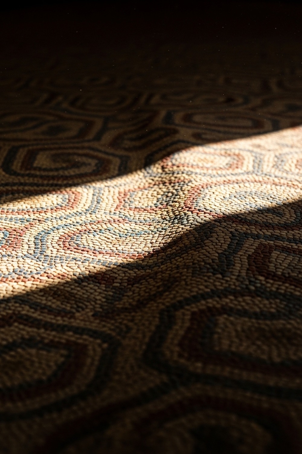
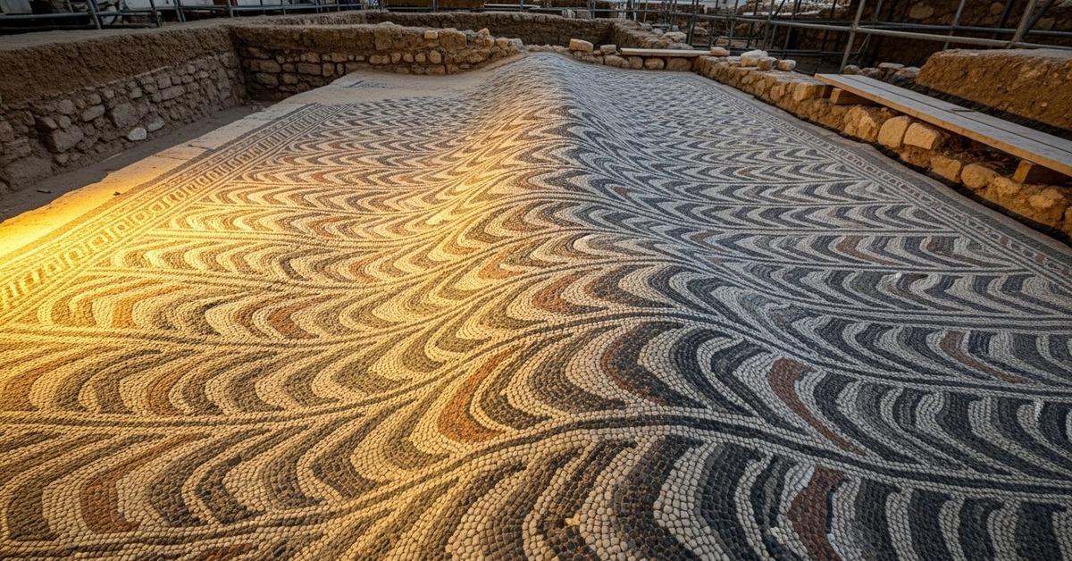
It wasn’t. The ripple pattern, measured using photogrammetric analysis and ground-penetrating radar, ran at an angle of roughly 68 degrees northeast — matching the dominant strike direction of the fault system with a precision that ruled out coincidence entirely. The tesserae — small cuts of marble, limestone, and colored glass averaging just 1.5 centimeters across — remained locked to one another. No pieces had been displaced. No mortar had fractured through. The surface had moved as a unified sheet, like a rug slid across a floor by an invisible hand, then frozen in place. To a geologist in 2019 holding a millimeter-scale measurement tool, it was unmistakable.
The color, remarkably, survived. Ochre and terracotta. Deep geometric borders in charcoal and cream. Whoever commissioned this floor had money and taste, and whatever shook their world didn’t take either of those things away permanently.
Roman Engineers Built Floors Designed to Survive the Earth
It would be easy to frame this as a lucky accident — a floor that happened to survive. But the engineering underneath the mosaic tells a more deliberate story. Roman builders in seismically active regions developed a layered foundation system called the nucleus and rudus (researchers actually call this the most sophisticated pre-modern seismic dampening approach in the Western archaeological record), a stratified base of rubble, sand, and lime mortar specifically designed to distribute and absorb mechanical stress. The result was a foundation that could flex rather than fracture — one that transferred load horizontally across the surface rather than concentrating it at weak points. At this-amazing-world.com, we’ve explored how ancient peoples read and responded to the natural world in ways that often put modern sensitivity to shame — this floor belongs in that conversation. The Romans living along fault lines didn’t necessarily understand plate tectonics. But they understood that ground moved, and they built accordingly.
What the evidence shows is engineering arrived at through pain, not theory. The layered substructure beneath the villa mosaic measures approximately 30 centimeters in total depth. The bottom layer — coarse rubble mixed with gravel — acted as drainage. The middle layer of finer mortar bonded the structure. The topmost lime layer, into which the tesserae were set, was kept deliberately thin: flexible enough to redistribute stress without shattering. Istanbul Technical University’s 2019 analysis estimated the foundation could absorb lateral displacement of up to 4 centimeters before any visible cracking would appear on the surface. The ripple measured in the mosaic falls within that tolerance by a margin of less than a millimeter.
Someone designed that margin. Someone calculated — empirically, through trial and catastrophic error across generations — exactly how much give a floor needed to outlast the earth’s movements. That person’s name is lost. Their calculation is not.
What the Ground Remembers That Documents Cannot
Why does this matter? Because earthquakes in the ancient world rarely left reliable written records, and everything we thought we knew about Roman seismic history was filtered through catastrophe.
Roman historians documented major seismic events — Pliny the Younger described the tremors that accompanied Vesuvius in 79 CE, and Ammianus Marcellinus catalogued a catastrophic earthquake and tsunami that struck Alexandria in 365 CE — but for the hundreds of smaller events that shaped daily life in seismically active provinces, the written record is nearly empty. What remains is embedded in the physical landscape: in tilted columns, cracked harbor walls, and now, in a deformed mosaic floor in western Turkey. According to research published by the Smithsonian Institution’s geology division on the intersection of archaeology and seismology, the emerging field of archaeoseismology has identified dozens of ancient structures across the Mediterranean that bear physical signatures of historical earthquake events — signatures that sometimes predate the earliest surviving written accounts of those same events by centuries. The Roman mosaic earthquake record from Asia Minor is now among the most precisely documented examples in that growing catalogue.
Treating deformed floors as imperfections, then photographing them and filing the photographs away, is the kind of methodological blind spot that history has a way of making look inexcusable in retrospect.
What makes this particular find unusual isn’t just the survival of the deformation pattern — it’s the survival of the color alongside it. Most archaeoseismic evidence comes from structural collapse: fallen columns, buckled retaining walls, ceramics shattered in situ. The Asia Minor mosaic offers something rarer: a record of a seismic event in a structure that survived the event intact. The Roman mosaic earthquake record here isn’t evidence of destruction. It’s evidence of resilience. That distinction changes how researchers model the magnitude and duration of the seismic event in question. A floor that bends without breaking implies a long-period, moderate-magnitude event — the kind produced by a slow fault rupture rather than a sudden strike-slip jolt.
That data point matters. Long-period events propagate differently through soil and sediment. They damage different types of structures. Knowing that a Roman villa in this precise location experienced — and survived — a long-period seismic event tells modern engineers something useful about what future seismic risk in the same area actually looks like.
Reading the Roman Mosaic Earthquake Record Across Other Sites
Since the Istanbul Technical University team published their preliminary findings in 2021, archaeologists at three other sites along the western Anatolian coast have re-examined previously catalogued mosaic floors using the same photogrammetric methodology. Two of those floors — one from a Roman bath complex near ancient Ephesus, one from a private villa site outside ancient Sardis — show similar deformation signatures. Neither had been previously identified as seismically significant. Both had been attributed to ground settling or uneven foundation work during original construction. The Ephesus floor carries a ripple orientation that aligns with a secondary splay fault running northeast of the main North Anatolian system.
And then there is the Sardis floor. Its deformation pattern suggests at least two distinct displacement events, separated by what researchers estimate — based on a thin calcite layer deposited between the deformation phases — by between 80 and 140 years. Two earthquakes. One floor. The floor was repaired between events, re-mortared in a slightly different lime composition, and then deformed again. Someone kept using it. Someone kept living there, kept walking across that surface, kept treating it as home, right through whatever the earth did to their world.
Researchers at the German Archaeological Institute in Istanbul are now developing a standardized protocol for identifying seismic deformation signatures in ancient mosaic floors across the broader Mediterranean region. If the methodology scales, it could eventually produce a seismic history of the Roman world that extends centuries deeper than anything currently available in written form. The identification of seismic deformation in Roman mosaic floors changes the calculus of what constitutes a historical earthquake record — catching the moderate, recurring seismicity that shaped daily life without appearing in any text. It’s the geological equivalent of reading between the lines of a document that never existed.

How It Unfolded
- 1st century CE — Roman villa complex constructed in western Anatolia on a layered sand-mortar-lime foundation system designed to accommodate regional seismic activity.
- 365 CE — A catastrophic earthquake and tsunami devastates the eastern Mediterranean; archaeoseismic researchers now suspect multiple smaller regional events preceded and followed it across the North Anatolian Fault corridor.
- 2019 — Istanbul Technical University researchers excavate the Asia Minor villa site and first observe the anomalous ripple pattern across the mosaic floor surface.
- 2021 — Photogrammetric analysis and fault-line orientation data confirm the ripple as a seismic deformation signature; findings prompt systematic re-examination of other regional Roman mosaic sites.
By the Numbers
- 1,500 km — Total length of the North Anatolian Fault, one of the world’s most active transform boundaries, running across northern Turkey into the Aegean Sea.
- 30 cm — Approximate depth of the Roman villa’s layered subfloor foundation, engineered to flex laterally during seismic events without transmitting fracture stress to the mosaic surface above.
- 1.5 cm — Average size of individual tesserae in the Asia Minor mosaic floor; thousands were laid across a surface area exceeding 40 square meters.
- 68 degrees — Northeast orientation of the mosaic’s ripple deformation, matching the dominant strike direction of regional fault splays to within 2 degrees of precision.
- 3 — Number of additional Roman mosaic floors along the western Anatolian coast identified with probable seismic deformation signatures following the 2021 Asia Minor publication.
Field Notes
- Between two displacement phases in the Sardis villa floor sits a thin calcite film — mineral residue left by groundwater seeping through micro-fractures — that allowed researchers to establish a rough time gap between seismic events. Deposition rates in similar sediment profiles suggest between 80 and 140 years separated the two episodes of ground movement, placing both within the Roman imperial period.
- Roman mosaic artists in seismically active provinces sometimes used smaller tesserae near floor edges than at the center — a pattern now being interpreted as a deliberate response to greater stress concentration at the margins of a flexing foundation panel, not simply aesthetic preference.
- Across roughly 8 meters of floor surface, the deformation in the Asia Minor mosaic rises and falls by only about 3 millimeters in total vertical displacement. Walking across it two millennia ago, you’d have felt nothing unusual underfoot.
- Researchers still can’t determine with certainty whether the mosaic’s deformation resulted from a single seismic event or from cumulative slow fault creep over decades. The distinction matters enormously for magnitude estimation — and the floor, for all it’s told us, hasn’t answered that question yet.
Frequently Asked Questions
Q: What exactly makes this a Roman mosaic earthquake record rather than just normal ground settling?
Normal ground settling produces random subsidence — irregular dips, localized sinking near drainage channels or structural load points. The deformation pattern’s orientation is what separates this find from that explanation. The ripple in the Asia Minor mosaic runs in a consistent directional plane across the entire floor surface, oriented at 68 degrees northeast, which matches the strike direction of regional fault structures measured by modern seismological surveys. That directional consistency, confirmed by photogrammetric analysis in 2019, rules out differential settling entirely.
Q: How did Roman builders know to engineer floors that could survive earthquakes?
They almost certainly didn’t frame it in those terms. Roman builders in seismically active regions like western Anatolia, Greece, and southern Italy developed layered foundation systems through accumulated empirical knowledge — essentially, they built floors that cracked, observed why they cracked, and adjusted. The nucleus and rudus system wasn’t invented with fault lines in mind; it was refined over generations because it demonstrably produced floors that lasted longer in regions where ground movement was frequent. Experience, not theory, drove the design — and the engineering solution preceded any theoretical understanding by centuries.
Q: Does this discovery change how archaeologists approach other Roman site excavations?
Increasingly, yes. Long-standing assumption held that deformed mosaic floors indicated poor original craftsmanship or later structural disturbance during reuse of a site. The Asia Minor find — and the subsequent re-examination of floors at Ephesus and Sardis — suggests that deformation patterns previously dismissed as manufacturing defects may actually be seismic signatures worth measuring. The German Archaeological Institute in Istanbul is now developing a standardized assessment protocol. If adopted widely, it could mean that hundreds of catalogued mosaics across Mediterranean museums and excavation archives need to be re-examined with fault-line orientation data in hand.
Editor’s Take — Sarah Blake
What strikes me hardest about this story isn’t the engineering — it’s the gap in the historical record that this floor is quietly filling. We’ve been reading Roman seismic history through texts written by people who only bothered to write down the catastrophes. The moderate events, the recurring tremors, the earthquakes that shook a household and then let it carry on — those disappeared entirely. And now here’s a floor saying: no, it happened. It happened here, at this angle, with this much force. A floor is finishing sentences that Roman historians never started.
Somewhere beneath western Turkey, there are almost certainly other floors like this one — floors carrying deformation signatures we’ve been cataloguing as imperfections for a century of excavation reports, then archiving, then forgetting. The earth has been writing its own record into every surface willing to hold an impression. We just hadn’t developed the patience, or the methodology, to read it. The question worth sitting with isn’t what this one mosaic tells us. It’s how many other records we’ve already found, photographed, measured, and filed away — without once asking what they were trying to say.