Melanesian Ocean Reserve: The Shark-Drawn Sanctuary
Draw a map of the world’s largest new ocean protection and you’d expect straight lines, treaty coordinates, a border argued over by diplomats. The Melanesian Ocean Reserve shark sanctuary was drawn differently — its boundaries were traced, in part, by following gray reef sharks fitted with satellite tags as they swam between coral shallows and deep-sea ridges. The widely repeated story is that governments decided where to protect. The stranger truth is that the animals showed them.
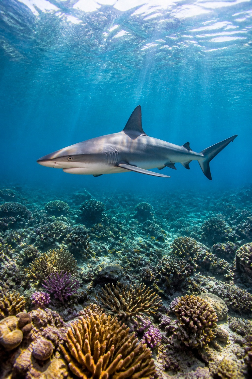
Announced at the UN Ocean Conference in Nice, France, in June 2025, this is a reserve built the way few others ever have been: from the movements of the wildlife it exists to save, and under the authority of the people who have governed these waters for millennia. Here’s what it actually is, how big it really is, and why the shark is the character everyone else left out of the story.
Key Facts
- The Melanesian Ocean Reserve is the world’s first Indigenous-led, multi-national ocean reserve, announced at the UN Ocean Conference in Nice in June 2025.
- It covers at least 6 million square kilometres (6,074,240 km2) — roughly the size of the Amazon rainforest.
- It pools the waters of Solomon Islands, Vanuatu and Papua New Guinea, connecting with New Caledonia’s EEZ.
- Its boundaries were shaped partly by satellite-tagging endangered gray reef sharks, revealing a marine highway corridor.
- The region holds roughly 75% of all known coral species; a 2024 survey documented 700+ reef fish and 300+ hard corals.
In short: The Melanesian Ocean Reserve, announced in June 2025, is the world’s first Indigenous-led, multi-national ocean reserve, covering at least 6 million square kilometres of the southwestern Pacific. Solomon Islands, Vanuatu and Papua New Guinea pooled their waters, connecting with New Caledonia. Its boundaries were shaped by tracking tagged gray reef sharks along a marine highway.
What the Melanesian Ocean Reserve shark sanctuary really is
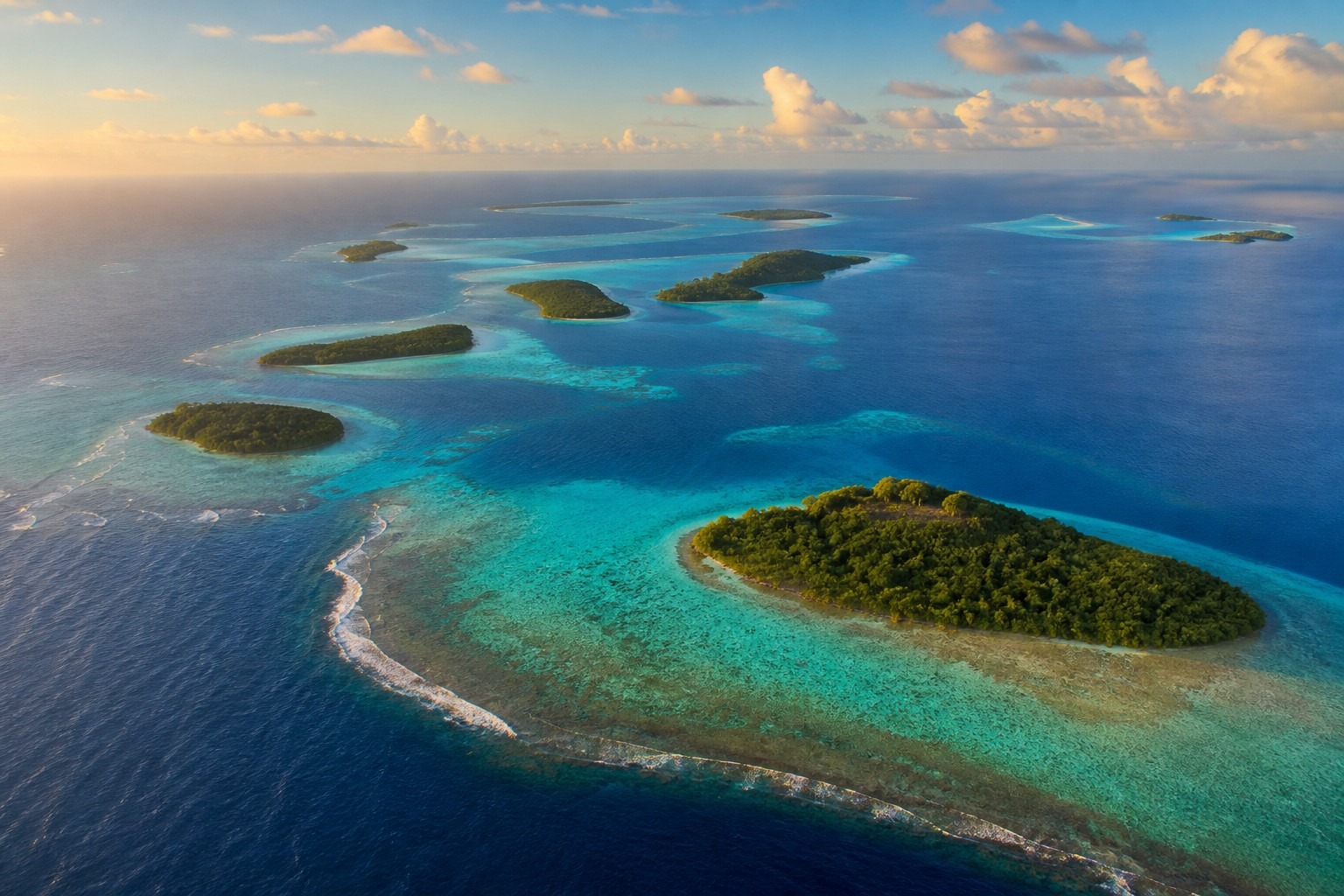
Strip away the headlines and the core fact is simple: this is the world’s first Indigenous-led, multi-national ocean reserve. Not a single country’s park, and not a distant proposal — a coalition of Pacific nations pooling their national waters into one connected sanctuary across the southwestern Pacific, where roughly 75% of all known coral species live.
The waters at its heart hold sharks, rays, dugongs, and whales, and the reserve is designed as a no-take zone — meaning commercial fishing and other extractive activities are barred, not merely discouraged. It was unveiled by the governments of Solomon Islands and Vanuatu, with Papua New Guinea’s waters folded in and New Caledonia’s protected zone connecting to the whole. Reporters reached for a comparison and found one: an ocean roughly as vast as the Amazon rainforest, something on the order of three and a half times the size of Alaska.
And why call it a shark sanctuary when most coverage just said “marine biodiversity”? Because the sharks are not incidental here. They are the reason the map looks the way it does.
Six million square kilometres — or more? The number, honestly
This is where competing accounts get muddy, so let’s be precise. Every official source anchors to the same figure: at least 6 million square kilometres — 6,074,240 km², to use the number the initiative itself publishes. That is the announced floor, covering the exclusive economic zones (EEZs) of Solomon Islands, Vanuatu, and Papua New Guinea.
- 6,074,240 km² — the announced protected area (“at least 6 million”), about the size of the Amazon rainforest
- 4 nations — Solomon Islands, Vanuatu, Papua New Guinea, connecting with New Caledonia’s EEZ
- ~75% — share of all known coral species found in the region
- June 2025 — announced at the UN Ocean Conference, Nice, France
- 214,000 km² — Papua New Guinea’s Western Manus MPA, added May 2026 (roughly the size of the UK)
You’ll also see larger totals thrown around when New Caledonia’s full EEZ and the wider connected network of Pacific protections are counted together. Those higher figures aren’t nonsense — they reflect a corridor of reserves that links up beyond the announced core. But if you want the honest, defensible number for the Melanesian Ocean Reserve itself, it’s the six-million floor. When a source quotes something bigger, it’s usually adding the connected waters, not describing a larger single reserve. That distinction is small, and it’s exactly the kind of thing most write-ups blur.
{IMAGE_2}
How gray reef sharks drew the boundaries
Turns out the most interesting part of this story is a piece of field science almost nobody reported. In 2024, National Geographic Pristine Seas ran a three-month expedition through Papua New Guinea’s remote waters, working with the country’s Conservation and Environment Protection Authority and the Wildlife Conservation Society. They surveyed reefs, dropped deep-sea cameras — and they tagged sharks.
Endangered gray reef sharks, specifically. When researchers followed the tagged animals, a pattern emerged: the sharks were commuting. They moved along a predictable route between shallow coral reefs and deep offshore habitats — underwater mountains, ridges, and canyons — a corridor scientists began calling a “marine highway.” Protect the reef but not the highway and you protect only half a life.
So the boundaries were shaped to follow the sharks’ real range rather than a convenient rectangle. And that is the quiet genius of it: a line drawn by an animal’s own biology is far harder to argue with than a line drawn by a committee. The same expedition documented more than 700 reef fish species and over 300 hard corals, and recorded deep-sea oddities including the yokozuna slickhead and gulper sharks — evidence, in one baseline survey, of just how much lives inside those tagged sharks’ commute.
Four nations, one corridor — who’s in and who’s connecting
The coalition has a clear core and a connecting partner. Solomon Islands and Vanuatu launched the reserve; Papua New Guinea’s national waters are part of the protected area; and New Caledonia’s already-protected EEZ links to the eastern edge, knitting the pieces into one continuous stretch of ocean.
The people behind it are named and accountable — worth noting, because vague “leaders say” coverage does this topic a disservice. The Honourable Trevor Mahaga, Solomon Islands’ Minister for Environment and Climate Change, and the Honourable Ralph Regenvanu, Vanuatu’s Minister for Climate Change Adaptation, are the two ministers who drove the concept. They developed it further with the Honourable Jelta Wong, Papua New Guinea’s Minister of Fisheries and Marine Resources. This is a political project with signatures on it, not an anonymous press release.
Indigenous-led, not Indigenous-named: how it actually runs
“Indigenous-led” is an easy phrase to print and a hard thing to mean. In this case it points to a specific machinery. The reserve is built on a living system of governance grounded in customary law — traditional authority isn’t just acknowledged in a preamble, it shapes how the ocean is managed day to day.
That machinery has real institutions attached. The Islands Knowledge Institute, an Indigenous-led organisation in Solomon Islands, has been the primary incubator of the whole initiative. Nia Tero, a group that channels direct funding to Indigenous guardianship, serves as the lead NGO partner, with the Wildlife Conservation Society and IUCN providing conservation backing. And the science-and-tradition bridge is a concrete programme, not a hope: the ARA Ocean Knowledge Partnership, led by Solomon Islands National University, integrates Indigenous knowledge with ocean research. Alongside it sit parallel national community programmes across the coalition — the reserve’s organisers describe these as active programmes, running now, rather than a plan waiting for funding. If that holds, it is the difference between enforcement and a good intention.
Why one connected reserve beats a scatter of sanctuaries
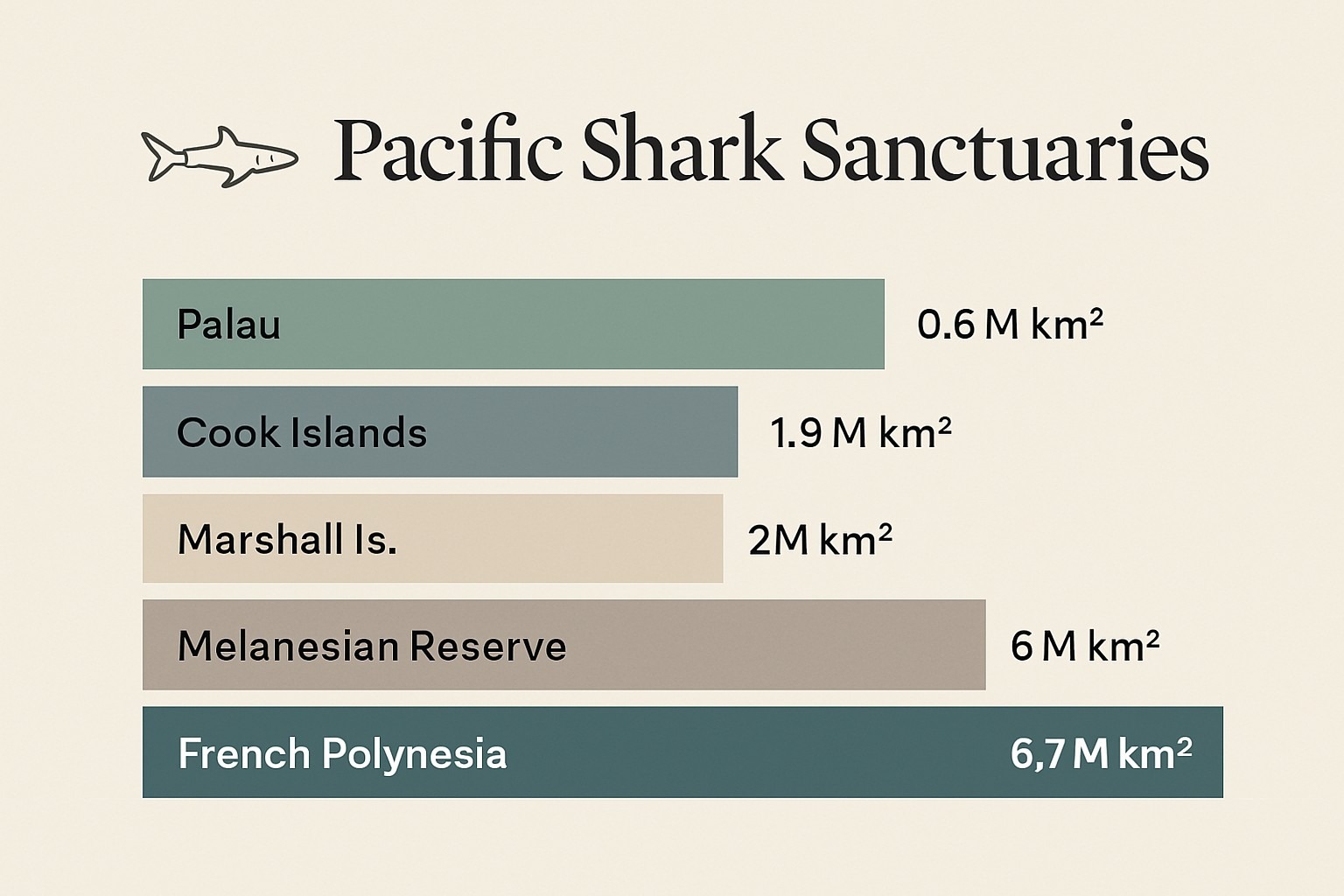
The Pacific already leads the world in shark protection — together, the region’s nations have declared sanctuaries covering more than 17 million square kilometres. So what does a connected coalition add that separate national zones didn’t? Continuity. A migrating shark doesn’t recognise an EEZ line; a corridor that spans four nations’ waters protects the animal across its whole journey, not just wherever it happens to be legal.
| Sanctuary | Nation(s) | Approx. area | Declared |
|---|---|---|---|
| Palau shark sanctuary | Palau | ~600,000 km² (its EEZ) | 2009 |
| Marshall Islands sanctuary | Marshall Islands | ~2 million km² | 2011 |
| French Polynesia sanctuary | French Polynesia | ~6.7 million km² | 2012 |
| Marae Moana | Cook Islands | ~1.9 million km² | 2012 |
| Melanesian Ocean Reserve | Solomon Is., Vanuatu, PNG (+ New Caledonia) | ~6 million km² | 2025 |
Notice what’s different about the last row. French Polynesia’s sanctuary is larger on paper, but it is one nation’s water. The Melanesian reserve is the first to stitch several sovereign EEZs into a single Indigenous-governed unit — a shared jurisdiction rather than a bigger fence. For a shark following its highway across national borders, that structural difference matters more than raw area.
What changed in 2026: Western Manus and the growing corridor
The story didn’t stop at the 2025 announcement. In May 2026, Papua New Guinea declared its largest marine protected area ever: the Western Manus MPA, covering roughly 214,000 square kilometres of the Bismarck Sea — an expanse close to the size of the United Kingdom — and designated strictly no-take. It was described as slotting into a larger framework now being called the Melanesian Ocean Corridor of Reserves.
Western Manus sits squarely on that shark-tracked marine highway, protecting habitat for scalloped hammerhead, gray reef, silky, and blacktip sharks, along with dolphins, pilot and beaked whales, and the strange deep-sea community below them. It is the clearest sign yet that the reserve is meant to grow reef by reef, corridor by corridor — the map filling in behind the sharks that first sketched it.
Common misconceptions, corrected
“It’s already fully in force.” Not quite. The reserve was announced as a shared commitment, and pieces like Western Manus are being formally designated over time. It is being built, not switched on overnight.
“It’s 8.7 million square kilometres.” The verified, official figure is at least 6 million km². Larger numbers describe the wider connected network of protected waters, not the announced reserve itself.
“It’s mainly about coral and tourism.” Coral is central, but sharks are the organising principle here — their tracked movements defined the boundaries, which is precisely why “shark sanctuary” is the accurate label.
“‘Indigenous-led’ is just branding.” The governance rests on customary law and named programmes such as the ARA Ocean Knowledge Partnership, run through Solomon Islands National University — a working mechanism, not a slogan.
Bottom line: The Melanesian Ocean Reserve is the world’s first Indigenous-led, multi-national ocean reserve — an area of at least six million square kilometres whose boundaries were shaped by tracking the very sharks it protects. It is smaller than the biggest single-nation sanctuary on paper, and more ambitious than any of them in practice, because it protects an animal across the whole of its journey rather than half of it.
Sources and notes
- Melanesian Ocean Reserve — official initiative materials, press kit, and FAQ (Governments of Solomon Islands and Vanuatu; Islands Knowledge Institute; Nia Tero)
- National Geographic Pristine Seas — 2024 Bismarck Sea expedition findings and gray reef shark tracking
- Wildlife Conservation Society and IUCN — conservation and biodiversity backing
- The Pew Charitable Trusts and Oceana — Pacific shark-sanctuary sizes and dates (Palau, Marshall Islands, French Polynesia, Cook Islands)
- Mongabay, EcoWatch, and Oceanographic — reporting on the UN Ocean Conference announcement and the 2026 Western Manus MPA
The next time you see a marine reserve announced with a big round number, it’s worth asking a small question: who, or what, decided where the line goes? In the southwestern Pacific, the answer is a fish with a satellite tag on its back — and a coalition of nations who decided, for once, to follow it.
Frequently Asked Questions
Q: What is the Melanesian Ocean Reserve?
It is the world’s first Indigenous-led, multi-national ocean reserve — a coalition of Pacific nations pooling their national waters into one connected sanctuary across the southwestern Pacific, where roughly 75% of all known coral species live. Designed as a no-take zone barring commercial fishing, it was unveiled by Solomon Islands and Vanuatu, with Papua New Guinea’s waters included and New Caledonia’s protected zone connecting to the whole. It was announced in June 2025.
Q: How big is the Melanesian Ocean Reserve?
The announced floor is at least 6 million square kilometres — precisely 6,074,240 km2, covering the exclusive economic zones of Solomon Islands, Vanuatu and Papua New Guinea. That is roughly the size of the Amazon rainforest, or about three and a half times Alaska. Larger totals sometimes quoted add New Caledonia’s full EEZ and the wider connected network, but the six-million figure is the honest number for the reserve itself.
Q: How did sharks help draw the reserve’s boundaries?
In 2024, National Geographic Pristine Seas ran a three-month expedition in Papua New Guinea’s waters and satellite-tagged endangered gray reef sharks. Following the tagged animals revealed a predictable commuting route between shallow coral reefs and deep offshore habitats — a corridor scientists called a marine highway. The boundaries were shaped to follow the sharks’ real range rather than a convenient rectangle, because a line drawn by biology is harder to argue with.
Q: Which nations are part of the reserve?
It has a clear core and a connecting partner. Solomon Islands and Vanuatu launched the reserve; Papua New Guinea’s national waters form part of the protected area; and New Caledonia’s already-protected EEZ links to the eastern edge. The ministers who drove it were Trevor Mahaga of Solomon Islands, Ralph Regenvanu of Vanuatu, and Jelta Wong of Papua New Guinea — a political project with signatures, not an anonymous press release.
Illustrations are AI-generated. Article fact-checked and human-edited. Our editorial standards.