Why Did Çatalhöyük Have No Streets? The Real Answer
In 1961, when the British archaeologist James Mellaart cut his first trench into a low double mound on Turkey’s Konya Plain, he uncovered a 9,000-year-old town that still forces a strange question on everyone who visits it: why did Çatalhöyük have no streets? There are no roads here, no alleys, not even a front door at ground level. Instead Mellaart found houses packed wall to wall like cells in a honeycomb, entered from above, through holes in their roofs. It looked less like a city than a single vast organism made of mud.
Key Facts
- James Mellaart cut his first trench into the Catalhoyuk mound on Turkey’s Konya Plain in 1961, uncovering a roughly 9,000-year-old town
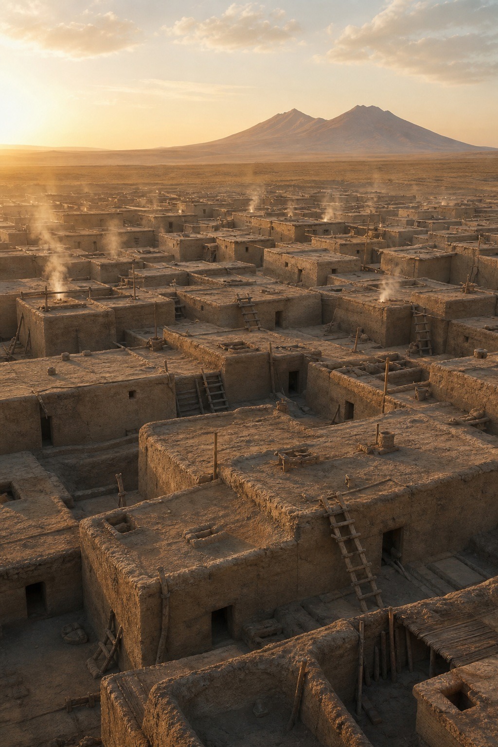
- Houses were built wall to wall with shared walls across an agglutinative plan roughly 13 hectares across, entered from above through roof openings with no ground-level doors
- Older estimates put peak population at 3,500 to 8,000; more recent modelling from the current excavation team suggests closer to 600 to 800 people at any one moment
- In June 2025 a team led by Eren Yuncu, with senior geneticist Mehmet Somel of Middle East Technical University, published a study in Science recovering ancient genomes from 131 individuals buried beneath house floors
- The genetic data showed people buried together shared the same maternal (mitochondrial) line while men often did not share a paternal line, pointing to a matrilocal, female-centred kinship system
In short: Catalhoyuk, a 9,000-year-old town on Turkey’s Konya Plain first trenched by James Mellaart in 1961, had no streets: houses shared walls and were entered through roof holes. A June 2025 Science study of 131 buried genomes found people in each house shared maternal lines, suggesting a matrilocal, female-centred kinship system.
A town built as one solid honeycomb
Çatalhöyük (roughly “cha-tal-hoo-yook”) sits on the Konya Plain in south-central Anatolia, and at its height it was one of the largest human settlements on Earth. Its houses were rectangular boxes of sun-dried mudbrick, built directly against their neighbours so that walls were shared and there was no gap between one home and the next. Fill in every gap on a city block, remove the sidewalks, and stack the whole thing tight — that is the layout.
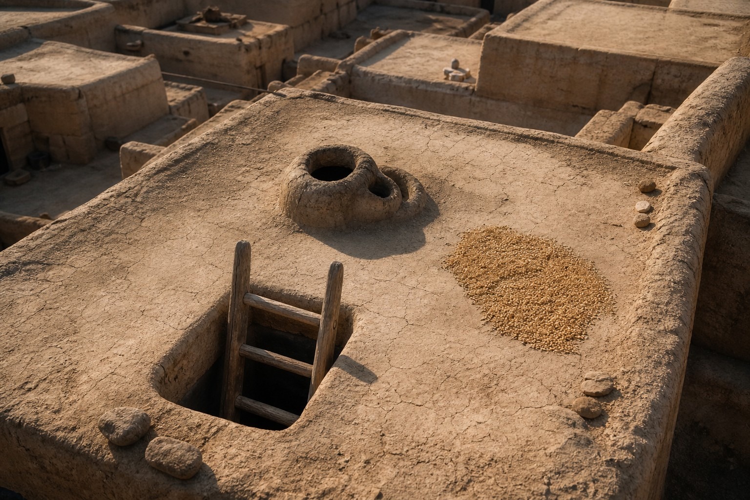
Because the walls touched, there was nowhere at ground level for a door. Each household reached its home by climbing a wooden ladder onto the flat clay roof, then dropping down through a rectangular opening set deliberately near the hearth. The same hole let cooking smoke out and daylight in. Below, the mudbrick houses had no windows at all.
The result is what archaeologists call an “agglutinative” plan — buildings glued together into one continuous mass roughly 13 hectares across. When one house wore out, its owners knocked in the walls, filled the shell with rubble, and built a near-identical house on top. Over centuries the town rose on its own debris into the mound Mellaart eventually spotted.
Commuting by ladder, nine thousand years ago
Picture the morning up there. With no streets, the rooftops were the streets — a rolling landscape of clay terraces at slightly different heights, linked by more ladders, where people walked, worked, gossiped, dried grain, and fired pottery. Ovens sometimes sat on the roofs too, so the skyline would have been threaded with columns of smoke.
And below that busy surface, darkness.
Step down the ladder and you entered a windowless room lit only by the smoke-hole and the hearth. Walls were replastered again and again — some carried red-ochre paintings, plaster reliefs, and the horned skulls of wild cattle set into benches. Turns out the “boring” mudbrick box was, inside, a decorated and deeply personal space. Living at Çatalhöyük meant a life divided cleanly in two: bright, communal, public roofs above; dim, private, ancestral rooms below.
That smoky interior left a mark on bone. Studies of the human remains by the excavation’s bioarchaeology team have noted soot deposits on rib surfaces and signs of respiratory stress — the physical residue of generations spent breathing hearth smoke in a room with one hole in the ceiling. The floors were kept scrupulously clean and replastered often, but the air, it seems, was another matter.
{IMAGE_2}
How crowded was it? That depends on which estimate you trust, and honestly they vary a lot. Older figures put the peak population as high as 3,500 to 8,000; more recent modelling from the current excavation team suggests something closer to 600 to 800 people living there at any one moment. Either way, squeezing hundreds of families onto 13 hectares with no open ground meant the roofs had to carry the daily traffic of an entire town.
Why did Çatalhöyük have no streets? Four old answers
For decades, the standard explanations were practical ones, and each has real merit. First, water: the Çarşamba River regularly flooded the plain, and a tightly packed block of buildings raised on its own mound sheds and survives floodwater far better than a scatter of free-standing houses with streets between them.
Second, defence. A settlement with no ground-level doors and only rooftop entry is remarkably hard to attack — pull up the ladders and the outer wall of houses becomes a blank rampart. Third, timber was scarce on the treeless plain, and the shared-wall design used far less wood than dozens of separate structures would have. Fourth, and vaguest, culture: many scholars argued the layout expressed a fiercely egalitarian society, where no house dominated another and no grand avenues led to any palace, because there was no palace and, as far as anyone can tell, no chief.
The egalitarian reading has real physical backing. Across the excavated buildings, houses are strikingly uniform in size and layout — no oversized mansions, no monumental temples raised above the crowd, no clear district for an elite. Nearly every house has its own hearth, its own storage, its own burials; the community seems to have been built of near-identical, largely self-sufficient households rather than ranked around a centre. A town with no main street is also, tellingly, a town with no obvious way to march toward anyone important.
All four are plausible. None, on its own, quite explains why people kept rebuilding in exactly the same spot, in exactly the same cramped way, for well over a thousand years.
2025: the DNA that reframed the question
In June 2025, a team led by Eren Yüncü, with senior geneticist Mehmet Somel of Middle East Technical University, published a study in the journal Science that changed the conversation. They recovered ancient genomes from 131 individuals buried beneath the house floors — the largest such dataset from any Neolithic site — and looked at who was related to whom, and how.
The pattern was striking. People buried together in a single building tended to share the same maternal line: their mitochondrial DNA matched. The men, by contrast, often did not share a common paternal line. The most economical reading is a matrilocal or female-centred kinship system, in which daughters stayed in the ancestral house across generations while husbands moved in from elsewhere. The researchers were careful, and so should we be — this is a strong signal, not a proven “matriarchy” in the political sense.
But apply it to the architecture and the honeycomb finally makes sense as a social object, not just an engineering one. If the house itself — the specific mudbrick shell, rebuilt again and again on the same footprint — was the anchor of a female-line family, then you would expect exactly what Çatalhöyük shows: homes clinging to their ancestral plot, growing into an unbroken grid of ancestor-homes rather than opening onto shared public roads. Read together, the flood-and-timber arguments explain how a town could be built without streets; only the kinship evidence explains why anyone would keep choosing to.
The volcano on one wall
There is a single painting at Çatalhöyük that ties the whole rooftop theory together. On a house wall, a red pattern of dots and lines sits above a two-peaked shape — long interpreted as a map of the town with an erupting volcano behind it. The obvious candidate is Hasan Dağ, a twin-peaked volcano visible on the horizon.
In 2014, geochronologist Axel Schmitt and colleagues, publishing in PLOS ONE, radiometrically dated volcanic rock from Hasan Dağ and found an eruption around 8,970 years ago — squarely within the town’s lifetime. So the residents could genuinely have watched that mountain smoke. And here’s the detail that matters for our question: the town in the painting is shown from above, as an interlocking grid of boxes, exactly the view you would get standing on your own roof. Whoever painted it wasn’t imagining an aerial view. They were painting the world as they walked through it — on the rooftops.
Living on top of the dead
The clearest sign that these houses were more than shelter lies under the floor. The people of Çatalhöyük buried their dead inside their homes — tucked in flexed positions beneath the raised platforms where the living slept and ate. Some houses hold only one or two burials; a few, which Ian Hodder of Stanford University, who reopened the excavation in 1993, called “history houses,” hold dozens accumulated over generations.
You did not just live in your house. You lived on your ancestors, and they on theirs — layer after layer, exactly as the buildings themselves were stacked. That folding-together of home, family, and grave is what the DNA evidence now illuminates from the inside.
The story is still being written. In August 2025 a team directed by Arkadiusz Marciniak of Adam Mickiewicz University in Poznań announced a structure they nicknamed the “House of the Dead,” holding the remains of at least 20 individuals who appear to have been brought there for burial rather than having lived and died on site — hinting at a dedicated mortuary building, not just domestic graves. Nearby, a large painted structure with 14 platforms awaits excavation. It is the freshest chapter in a dig that has run, on and off, for more than sixty years.
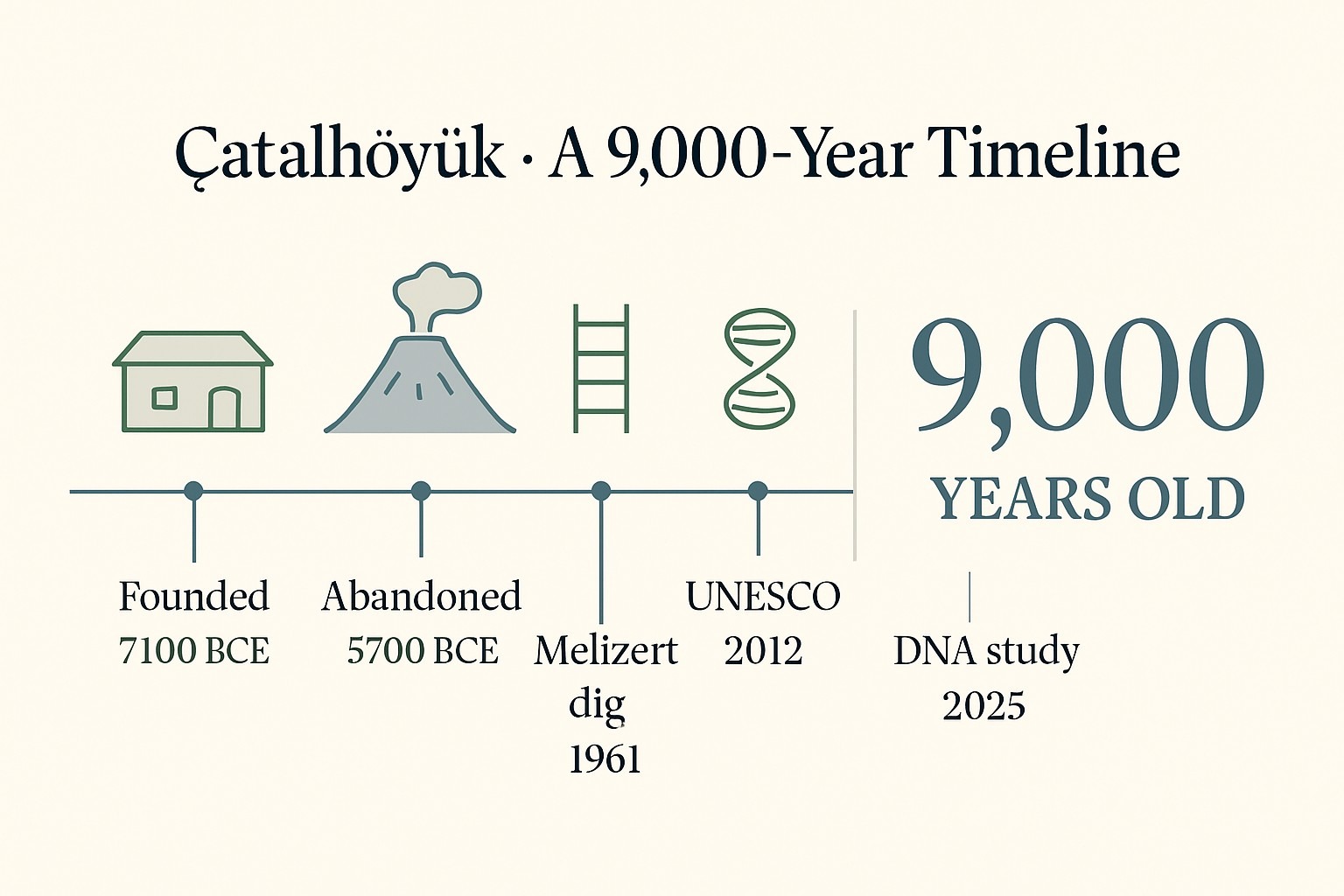
- c. 7100 BCE — First mudbrick houses rise on the East Mound, Konya Plain
- c. 7000 BCE — Hasan Dağ erupts (dated 8,970 ± 640 years ago); the volcano mural is painted
- c. 5700 BCE — The last inhabitants finally leave the site
- 1961 CE — James Mellaart begins the first major excavation
- 1993 CE — Ian Hodder reopens the dig with modern methods
- 2012 CE — UNESCO inscribes Çatalhöyük as a World Heritage Site
- 2014 CE — The volcano mural is radiometrically dated (PLOS ONE)
- 2025 CE — DNA reveals female-centred kinship; the “House of the Dead” is found
The same idea, reinvented in the American desert
Was the no-streets town a one-off Neolithic quirk? Not quite. Roughly eight thousand years later and half a world away, the Ancestral Puebloan peoples of the American Southwest built villages on the very same logic — clustered rooms with shared walls, few or no ground-level doors, and access by ladder over the rooftops. At Acoma Pueblo in New Mexico, continuously inhabited for around a thousand years, that rooftop-and-ladder design served the same functions it did on the Konya Plain: defence, thermal comfort, and a tight-knit community with no need for streets.
Two societies with no possible contact arrived at nearly identical architecture. That is a good clue that the honeycomb is not a bizarre accident but a genuine, repeatable solution — one of the sensible ways human beings solve the problem of living close together in a harsh, open landscape.
Common questions
How old is Çatalhöyük? The settlement was occupied from roughly 7100 to 5700 BCE, making it about 9,000 years old — one of the oldest and largest known Neolithic towns.
How did people get into their houses? There were no ground-level doors. Residents climbed a ladder onto the flat roof and descended through an opening near the hearth, which also vented smoke and let in light.
Sources and notes
- Yüncü, E., Somel, M., et al. — “Female lineages and changing kinship patterns in Neolithic Çatalhöyük,” Science (2025)
- Çatalhöyük Research Project (Ian Hodder, Stanford University) — excavation seasons 1993–2018
- Schmitt, A. K., et al. — “Identifying the Volcanic Eruption Depicted in a Neolithic Painting at Çatalhöyük,” PLOS ONE (2014)
- UNESCO World Heritage Centre — Neolithic Site of Çatalhöyük, inscribed 2012 (Ref. 1405)
- Mellaart, J. — original excavation reports, Anatolian Studies, British Institute at Ankara (1961–1965)
- Adam Mickiewicz University, Poznań (Arkadiusz Marciniak) — “House of the Dead” excavation announcement, 2025
Nine thousand years on, Çatalhöyük still refuses to behave like a city we would recognise — no roads, no square, no palace, just a great mud honeycomb where the roofs were the roads and the dead lay under the living. For a long time we explained that away with floods and firewood. The newest evidence suggests something warmer and stranger: a town shaped less by engineering than by belonging, where families stayed put across the centuries because the house itself was the ancestor. The dig continues, and every season the answer to that first simple question grows a little richer.
Frequently Asked Questions
Q: Why did Catalhoyuk have no streets?
Its rectangular mudbrick houses were built directly against their neighbours with shared walls and no gaps between homes, so there was nowhere at ground level for a door or a road. People reached each house by climbing a wooden ladder onto the flat clay roof and dropping through a rectangular opening near the hearth. The rooftops functioned as the streets. Older explanations cite flood survival, defence, scarce timber, and an egalitarian culture, but no single reason fully explains why people rebuilt this way for over a thousand years.
Q: How did people enter and live in the houses?
Each household climbed a wooden ladder onto the flat roof, then dropped down through a rectangular hole set near the hearth, which also let cooking smoke out and daylight in. The windowless mudbrick rooms below were lit only by the smoke-hole and hearth. Walls were replastered repeatedly, some carrying red-ochre paintings, plaster reliefs, and horned cattle skulls set into benches. Life was divided in two: bright, communal, public roofs above and dim, private, ancestral rooms below.
Q: How many people lived at Catalhoyuk?
Estimates vary widely. Older figures put the peak population as high as 3,500 to 8,000, while more recent modelling from the current excavation team suggests something closer to 600 to 800 people living there at any one moment. Either way, squeezing hundreds of families onto about 13 hectares with no open ground meant the rooftops had to carry the daily traffic of an entire town, with people walking, working, drying grain, and firing pottery on the terraces above.
Q: What did the 2025 DNA study reveal about Catalhoyuk?
In June 2025 a team led by Eren Yuncu, with senior geneticist Mehmet Somel of Middle East Technical University, published a study in Science that recovered ancient genomes from 131 individuals buried beneath house floors, the largest such dataset from any Neolithic site. People buried together in one building tended to share the same maternal mitochondrial line, while the men often did not share a paternal line. The most economical reading is a matrilocal, female-centred kinship system where daughters stayed in the ancestral house while husbands moved in.
Illustrations are AI-generated. Article fact-checked and human-edited. Our editorial standards.