How Did Ancient Sailors Navigate Without Instruments?
How did ancient sailors navigate when there were no charts, no compass, and no instrument more complex than a knotted string? They did something we have largely forgotten how to do — they read the world itself, braiding the sky overhead, the living ocean around them, and centuries of oral memory into a continuous mental fix on their position. The result was not luck. Pacific voyagers crossed thousands of kilometres of open water to find specks of land smaller than a city; Phoenicians ran a Mediterranean trade empire; Vikings made it to Newfoundland. This is the story of how they did it.
Key Facts
- Austronesian and Polynesian seafarers crossed more than 6,000 km of open Pacific Ocean to settle remote islands such as Tonga and Samoa by roughly 900 BC — centuries before any European deep-water chart existed.
- A trained Pacific master navigator could memorise a “star compass” of up to 150 stars, each with its known rising and setting point on the horizon, used as a 360° mental dial.
- The Arab kamal, a navigation tool no bigger than a playing card, used a knotted string and a small wooden rectangle to measure a star’s altitude — and therefore latitude — to within roughly one degree.
- Viking sagas describe a sólarsteinn or “sunstone,” now widely identified as Iceland spar (a clear calcite crystal), used to locate the hidden sun by reading its polarised light through cloud and fog.
- Chinese mariners were using a magnetic compass for navigation by roughly 1040–1117 AD — about a century before its first documented seagoing use in Europe.
In short: Ancient sailors did not “lack” navigation. They had a deeply layered system — celestial bearings, environmental signals, and inherited route knowledge — that, in the hands of trained specialists, was accurate enough to find a tiny atoll after weeks at sea. The compass and the chronometer did not replace these methods so much as freeze a few of their best tricks into metal.
Key Facts
- Austronesian and Polynesian seafarers crossed more than 6,000 km of open Pacific to settle remote islands such as Tonga and Samoa by roughly 900 BC.
- A trained Pacific master navigator could memorise a ‘star compass’ of up to 150 stars, each with its known rising and setting point, used as a 360° mental dial.
- The Arab kamal, a tool no bigger than a playing card, used a knotted string and a small wooden rectangle to measure a star’s altitude — and therefore latitude — to within roughly one degree.
- Viking sagas describe a sólarsteinn or ‘sunstone,’ widely identified as Iceland spar (clear calcite), used to locate the hidden sun by reading polarised light through cloud and fog.
- Chinese mariners were using a magnetic compass for navigation by roughly 1040–1117 AD, about a century before its first documented seagoing use in Europe.
In short: Ancient sailors navigated without instruments using a layered three-sense system: celestial bearings from stars and sun, environmental signals like swells, birds and cloud loom, and inherited route knowledge. In trained hands this was accurate enough to find a tiny atoll after weeks at sea, long before the compass and chronometer existed.
How Did Ancient Sailors Navigate Without Instruments? The Three-Sense System

The honest answer is that no ancient culture relied on a single trick. The Polynesian master navigator Mau Piailug, who in 1976 sailed the recreated voyaging canoe Hōkūleʻa from Hawaiʻi to Tahiti with no instruments at all, used to describe wayfinding as a continuous flow of information from every direction at once — what is now sometimes called multi-cue integration.
Three “senses” did most of the work. The first was the sky — the rising and setting points of stars, the height of the Sun, and the position of the Moon. The second was the ocean itself — the direction of long swells, the colour of the water, the sea-floor sediments brought up on a lead line, the loom of clouds above hidden land, the flight paths of seabirds. The third, and most underrated, was memory — chants, sailing directions, written periploi, and apprenticed knowledge that turned a route from “guessing” into “reciting.”
This is the framework worth holding in mind as we move through the specific cultures. None of them had a magic technique. They had a stack — and the discipline to keep cross-checking every layer.
Reading the Stars: Celestial Navigation Before the Astrolabe
Long before the medieval astrolabe, sailors discovered the most useful fact in pre-instrument navigation: the height of a known star above the horizon is your latitude. In the Northern Hemisphere, the angle of Polaris (the North Star) above the horizon is almost exactly your latitude in degrees. South of the equator, Polynesian, Arab, and later Portuguese navigators used the Southern Cross and other near-pole markers in similar ways.
{IMAGE_2}
The practical technique is called latitude sailing, and it was the workhorse of pre-modern blue-water voyaging. You first sailed north or south until your target star sat at the right height, then turned and ran east or west, keeping that altitude constant. You might overshoot your destination’s longitude, but you would not miss its latitude. Phoenician, Greek, Arab, and Polynesian navigators all converged on variants of this idea, because the geometry of the spinning Earth made it inevitable.
The Greeks formalised the underlying astronomy. Pytheas of Massalia, around 325 BC, used a gnomon (a vertical stick whose noon shadow length encodes the Sun’s altitude) on his voyage to the British Isles and beyond, and reported latitude figures so accurate that modern reconstructions place him as far north as the Shetlands or Iceland. The Minoans before him had already aligned palace architecture with equinox sunrises and the risings of bright stars — a clue that systematic sky-watching predated written astronomy by centuries.
Reading the Living Ocean: Swells, Birds, and Cloud Loom
When the sky was overcast, ancient sailors did not stop navigating. They simply changed channels. The ocean itself carries an enormous amount of information for someone trained to read it.
Long swells are the most useful. A long-period swell generated by a distant storm can travel for thousands of kilometres in a near-straight line. A trained navigator could feel two or three different swell systems passing under the hull at once, hold their direction in mind, and use them as a steering reference even when the wind and waves on the surface were chaotic. Polynesian voyagers described “lying down in the canoe” to feel swells through the body when visibility failed entirely.
Seabirds were a second channel. Land-based species such as white terns and noddy terns return to land each evening to roost. A navigator who saw a flock of noddies flying purposefully at dusk knew that land lay along their flight line and was usually within roughly 50 km. In the morning they flew the opposite way to fish — so the rule was: follow them at dusk, follow them in reverse at dawn.
Cloud loom was the third. White sand and coral atolls reflect heat and light upward, producing a faintly bright underside on low cumulus directly above the island. Subtle greens or turquoise in the underside of clouds betrayed shallow lagoons below. A skilled wayfinder could see an island, hours before its actual peak rose above the horizon, written in the sky.
The Polynesian Star Compass and the Etak System
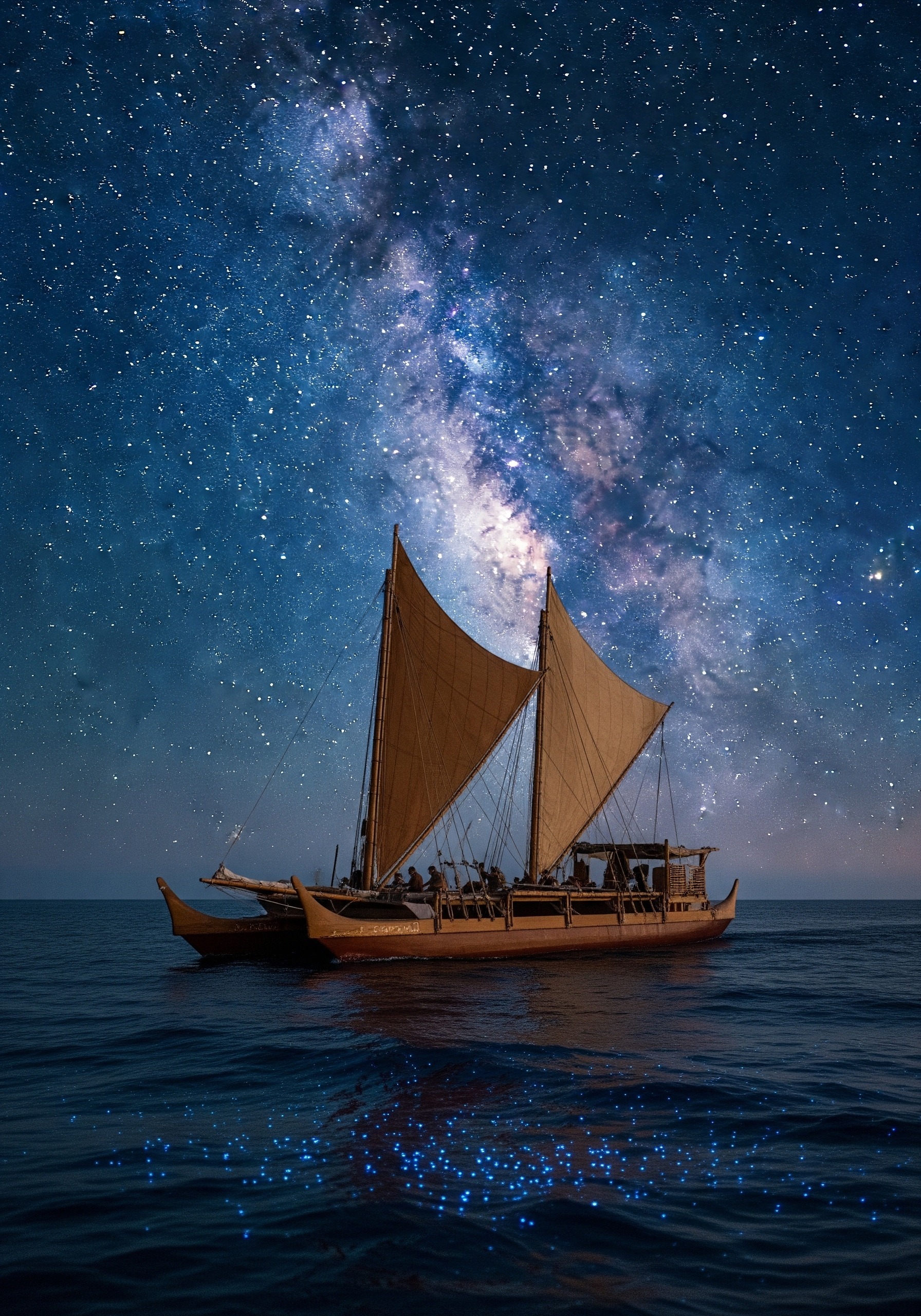
Of all the ancient navigation systems, Pacific wayfinding is the most spectacular — and the one most underplayed in popular accounts. The Polynesian star compass was not a physical device. It was a mental 360° dial divided into named “houses” on the horizon, each marked by the rising or setting point of a specific star. Depending on the route, a navigator might carry between seven and 150 stars in active memory, and could switch from one to the next as each set or rose during the night.
Layered on top of this was a remarkable conceptual trick called etak. Instead of imagining the canoe moving past stationary islands, the navigator imagined the canoe as stationary and a reference island off to the side sliding past it under a moving star. Each time the reference island reached the next “star house” on the horizon, you knew you had completed one etak — one segment of the voyage. It is a moving-frame reference system, mathematically elegant, and it allowed dead reckoning across hundreds of kilometres of open water without writing a single number down.
The 18th-century Tahitian navigator Tupaia demonstrated the system’s reach when he sailed with Captain James Cook in 1769. He could name some 130 islands across roughly four million square kilometres of Pacific Ocean and helped Cook draw a chart of 74 of them, pointing back to Tahiti from any position aboard the Endeavour with no instruments. The modern revival of voyaging began in 1976, when Mau Piailug — a navigator from the tiny atoll of Satawal in Micronesia — guided the canoe Hōkūleʻa from Hawaiʻi to Tahiti using nothing but the traditional star compass, swells, and birds.
Phoenicians, Greeks, and the Written Coast
In the Mediterranean, the navigation problem was different. Distances were shorter and the coast was usually within a day or two of the horizon, but the sea is studded with islands, hidden shoals, and capes that look identical at distance. Here the killer tool was not the star compass but written memory.
The Phoenicians, the great seafaring traders of the first millennium BC, used a weighted, marked rope called a sounding line (also known as a lead line) — possibly the very first purpose-built navigational instrument. They lowered it to measure depth and, crucially, to bring up a small sample of the seabed in tallow stuck to its base. A specific combination of depth and sediment (white sand at 20 fathoms, then dark mud at 15) was a fingerprint that told an experienced pilot exactly where he was on a known coast.
The Greeks turned this oral knowledge into text. A periplus (“sailing around”) was a written sailing direction, listing in order the harbours, capes, water sources, and dangers along a coastline, with rough distances between them. Hanno the Carthaginian sailed down the West African coast around 500 BC and brought back a periplus that named landmarks as far south as modern Gabon. Two centuries later, the famous Periplus of the Erythraean Sea catalogued ports from the Red Sea to India. These were the operating manuals of Mediterranean and Indian Ocean trade for the better part of a thousand years.
Vikings, Sunstones, and the Polarised Sky
The Norse had a brutal navigation problem. They sailed in the high North Atlantic, where overcast often hides the Sun and stars for days, and where the magnetic North Pole’s behaviour is treacherous. Yet by the early 11th century they had reached L’Anse aux Meadows in Newfoundland — a journey from Scandinavia of over 5,000 km — and re-supplied an Icelandic and Greenlandic colony for generations.
Their tricks were a mix of the simple and the surprising. The simple ones included latitude sailing from Norway directly west to Greenland along a remembered latitude, judged by the Sun’s noon height and by familiar bird and whale species. The surprising one is the sólarsteinn, the “sunstone” mentioned in Icelandic sagas. For decades it was treated as legend. Then physicists pointed out that Iceland spar, a transparent calcite crystal common in Norse territories, splits unpolarised light in a way that makes it possible to locate the Sun’s position through dense cloud. Rotate the crystal until two refracted beams appear equally bright, and you are pointing toward the hidden Sun. A piece of Iceland spar found in 2013 in a sunken 1592 English ship lent the theory archaeological weight.
Arab Dhows, the Kamal, and the Monsoon Highway
By the early medieval period, Arab navigators were running the most consistent long-distance trade route on Earth — across the Indian Ocean from East Africa to India and onward to Southeast Asia, riding the seasonal monsoon winds. Their instrument was beautifully minimal: the kamal.
How the kamal worked — a one-degree navigation tool the size of a credit card
- Hardware: a flat rectangle of wood or bone (typically about 5 × 2 cm) with a knotted string passing through its centre.
- Method: hold a knot between your teeth, stretch the string taut, and align the bottom edge of the rectangle with the horizon. Adjust until the top edge touches a chosen reference star (often Polaris).
- Reading: the knot at your teeth encodes a specific latitude. Each knot was tied to match the latitude of a known port. If Polaris sat exactly between the upper and lower edge at the “Aden” knot, you were on Aden’s latitude — anywhere east or west.
- Accuracy: roughly within one degree of latitude (about 110 km) in skilled hands. The Portuguese later copied the design directly when they arrived in the Indian Ocean.
The kamal is a perfect example of why “no instruments” is a misleading question. Ancient navigation was not always instrument-free; it was often instrument-frugal. A single carved rectangle and a piece of string did the work that we now expect from satellites.
Ancient Navigation by Civilisation: A Comparison
To see how the pieces fit together, it helps to lay the great seafaring cultures side by side. Each adapted the same basic toolkit — sky, sea, memory — to the specific ocean it sailed.
| Culture | Era | Signature method | Key instrument |
|---|---|---|---|
| Austronesian / Polynesian | ~3000 BC – present | Star compass, etak, swell + bird reading | None (memorised) |
| Phoenician / Carthaginian | ~1500 – 300 BC | Coastal piloting, sediment fingerprinting | Lead / sounding line |
| Greek | ~700 BC – 200 AD | Gnomon-based latitude, periploi | Gnomon, written guides |
| Viking / Norse | ~800 – 1100 AD | Latitude sailing, polarised-light sun-finding | Sunstone (Iceland spar) |
| Arab / Indian Ocean | ~800 – 1500 AD | Kamal latitude, monsoon timing | Kamal, quadrant |
| Chinese | ~1040 AD onward | Magnetic compass + charts | Wet-needle compass |
Two patterns leap out of the table. First, latitude sailing was independently rediscovered by almost every ocean culture, because the geometry of stars and Earth allows nothing else as simple. Second, the magnetic compass arrived late — China between roughly 1040 and 1117 AD, Europe about a century later — and inherited a navigation tradition that was already mature, not primitive. The compass was an upgrade, not an invention from zero.
The Slow Birth of the Instrument: From Memory to Metal
So how did this 5,000-year-old fabric of methods turn into the brass-and-glass instruments we picture today? Gradually, and unevenly. The Greek Antikythera mechanism, a corroded bronze device recovered from a Mediterranean shipwreck dated to roughly the 1st century BC, was an astronomical calculator that could predict eclipses and planetary positions — strong evidence that complex mechanical astronomy existed long before it reached ships. Islamic scholars perfected the planar astrolabe in the 8th and 9th centuries, originally for prayer-time and qibla calculations on land; sailors adapted a simpler mariner’s astrolabe from it by the late medieval period.
By the time the cross-staff, the back-staff, and finally the sextant arrived in the 16th and 18th centuries, ocean navigation had been reliable for thousands of years — just not portable, not standardised, and not teachable from a book. What changed was not accuracy. What changed was who could do it. Instruments turned navigation from a lifelong apprenticeship into a skill any literate officer could learn in a season. The art compressed into a tool. For more on the ancient world’s quiet technological depth, see our explainer on the Antikythera mechanism, and our long read on the Phoenician trade routes that those navigators powered.
Frequently Asked Questions
Q: How did ancient sailors navigate at night?
A: Primarily by stars. In the Northern Hemisphere, Polaris (the North Star) gave them latitude directly — its angle above the horizon equals your latitude. South of the equator, navigators used the Southern Cross and other near-pole stars in similar ways. Polynesian wayfinders memorised whole “star compasses” of up to 150 stars and switched from one to the next as each rose and set during the night.
Q: How did ancient ships navigate when it was cloudy?
A: They fell back on the ocean itself. Long swells generated by distant storms travel in nearly straight lines for thousands of kilometres, and a trained navigator could feel multiple swell systems through the hull and use them as a steering reference. Vikings additionally used the sólarsteinn or sunstone — a calcite crystal that reveals the Sun’s polarised light through overcast — to locate the hidden Sun.
Q: How did ancient mariners navigate before the compass?
A: With a layered system of celestial bearings (Polaris, Southern Cross, the noon Sun’s altitude), environmental cues (swells, seabirds, cloud loom over hidden islands, water colour), and inherited route knowledge (oral chants, the periplus sailing-direction tradition, apprenticed master-navigator training). The magnetic compass, developed in China around 1040–1117 AD, was an addition to this stack, not a replacement.
Q: How accurate was ancient navigation, really?
A: Better than modern audiences usually assume. The Arab kamal could fix latitude to roughly one degree (about 110 km). Polynesian navigators routinely found target islands a few kilometres across after voyages of 4,000 km or more. Longitude was the hard problem — it could not be solved precisely until the marine chronometer of the late 1700s — but east–west position was approximated well enough through dead reckoning and the geometry of expected landfall.
Ancient navigation looks like magic from the outside because we no longer carry its skills in our bodies. We outsource direction to a glowing rectangle. But the navigators of Polynesia, Phoenicia, the Norse coast, and the Arabian dhow were not working without information — they were drowning in it, and had simply learned to listen. The next time you cannot find a street without GPS, remember Mau Piailug, lying down in a canoe in the open Pacific, feeling for three different swell systems with his ribs. He found Tahiti. With your phone off, could you find your way home from the next town over? The instruments we celebrate did not give us the sea. They only made it cheaper to forget how to read it. Useful further reading: the Naval History and Heritage Command’s overview of navigation history, the Polynesian Voyaging Society’s archive of Hōkūleʻa voyages, and the Smithsonian’s notes on ocean exploration.
Illustrations are AI-generated. Article fact-checked and human-edited.