Lost Cities of the Ancient World Still Being Discovered
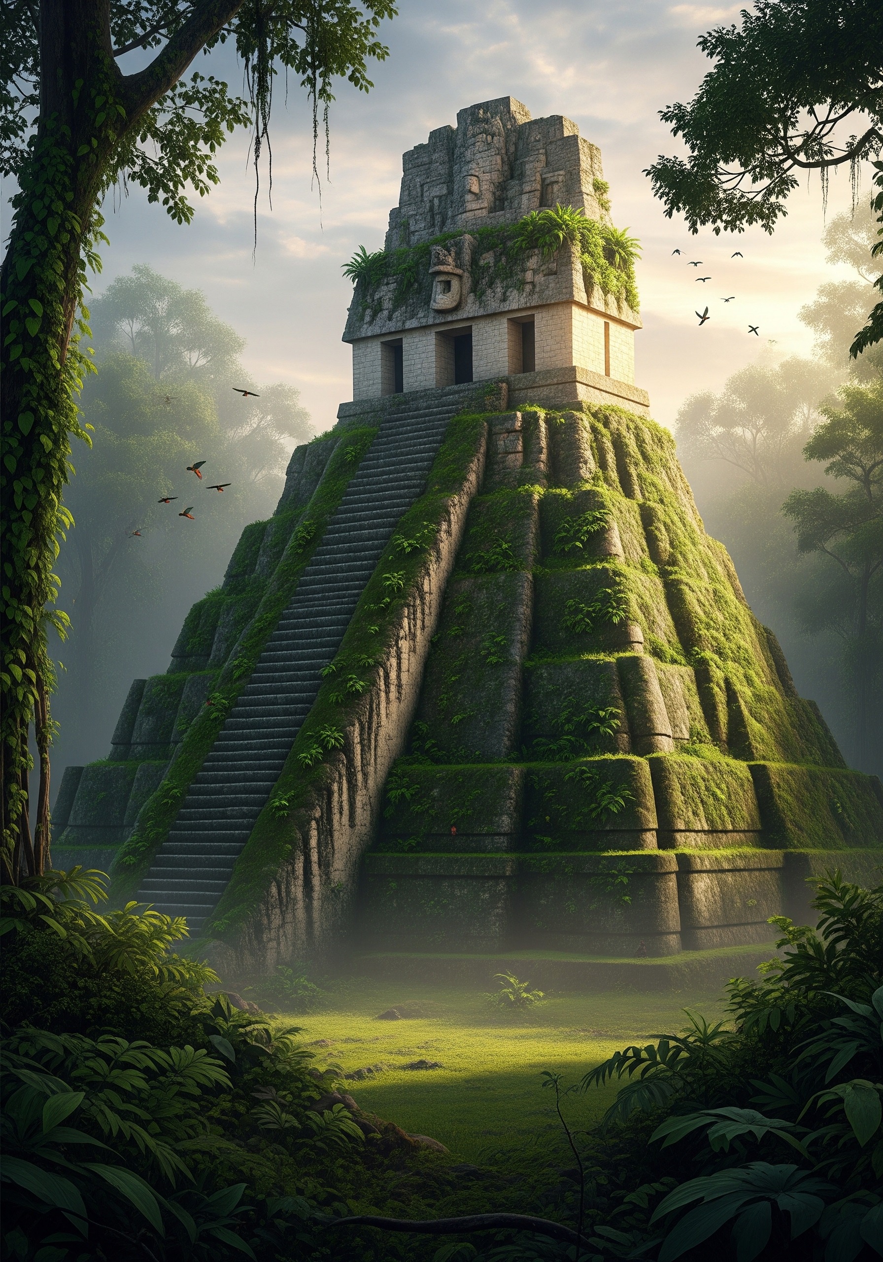
The lost cities of the ancient world are still being discovered — and at a pace no generation before ours has witnessed. In October 2024, a Tulane University doctoral student opened a publicly available laser-scan dataset from 2013 and noticed something nobody else had: a sprawling Maya metropolis, complete with pyramids, ballcourts, and reservoirs, sitting unnoticed beside a working Mexican highway for more than a decade. He named it Valeriana. It is now considered one of the densest Maya cities ever mapped — and it had never been touched by an archaeologist.
Key Facts
- Valeriana, a previously unknown Maya city in Campeche, Mexico, was revealed in 2024 from existing 2013 LIDAR data — researchers identified 6,764 structures across the surveyed area.
- In Ecuador’s Upano Valley, LIDAR has uncovered at least 15 interconnected pre-Columbian settlements containing more than 6,000 earthen platforms, dated as early as 500 BC.
- Some of the most famous “lost cities” — Petra, Machu Picchu, Troy — were never truly lost to local people; they were unknown only to Western scholarship until the 19th and early 20th centuries.
- At least six ancient capitals named in surviving texts — including Akkad, Itjtawy, and Thinis — remain entirely unlocated despite a century of searching.
- Estimates published in Science suggest between 10,000 and 24,000 pre-Columbian earthworks may still lie buried beneath the Amazon canopy.
In short: The age of finding lost cities is not over — it is accelerating. Airborne LIDAR, satellite radar, and re-analysed environmental data are revealing entire urban civilisations that history books, until very recently, did not know existed.
Key Facts
- Valeriana, a previously unknown Maya city in Campeche, Mexico, was revealed in 2024 from existing 2013 LIDAR data; researchers identified 6,764 structures across the surveyed area.
- In Ecuador’s Upano Valley, LIDAR has uncovered at least 15 interconnected pre-Columbian settlements containing more than 6,000 earthen platforms, dated as early as 500 BC.
- Some famous ‘lost cities’ like Petra, Machu Picchu and Troy were never truly lost to local people — only unknown to Western scholarship until the 19th and early 20th centuries.
- At least six ancient capitals named in surviving texts — including Akkad, Itjtawy and Thinis — remain entirely unlocated.
- Estimates published in Science suggest between 10,000 and 24,000 pre-Columbian earthworks may still lie buried beneath the Amazon canopy.
In short: The age of finding lost cities is accelerating, not ending. Airborne LIDAR, satellite radar and re-analysed environmental data are revealing entire urban civilisations that history books did not know existed, from the Maya city of Valeriana found in 2024 to 2,500-year-old settlements in the Ecuadorian Amazon.
Why Lost Cities of the Ancient World Are Still Being Found
A reasonable person in 1900 might have assumed that, by now, the map of the ancient world would be more or less complete. The opposite is true. The 2020s have produced more verified discoveries of vanished urban civilisations than any decade since archaeology became a science. The reason is not that ruins are surfacing from the soil. It is that we finally have the tools to see them through it.
Most of the great ancient cities were not destroyed in a single catastrophe. They were drained of people, then drained of memory, then swallowed by what came next — by jungle, by sand, by silt, by farmland, by suburb. Their tombstones are subtle: a too-straight ridge in a forest, a faint rectangle in a wheat field, a hill where no hill should be. For 200 years, archaeologists could only find these signs by walking over them. Today, lasers, satellites, and ground-penetrating radar can find them from the sky.
The LIDAR Revolution: How Lasers See Through the Jungle
LIDAR — Light Detection and Ranging — works by firing millions of laser pulses per second from a low-flying aircraft and timing how long each takes to return. Software then strips out the returns that bounced off leaves and branches, leaving a bare-earth model that reveals every ridge, mound, and ditch beneath the forest canopy. What used to require decades of machete-clearing now takes a single afternoon’s flight.
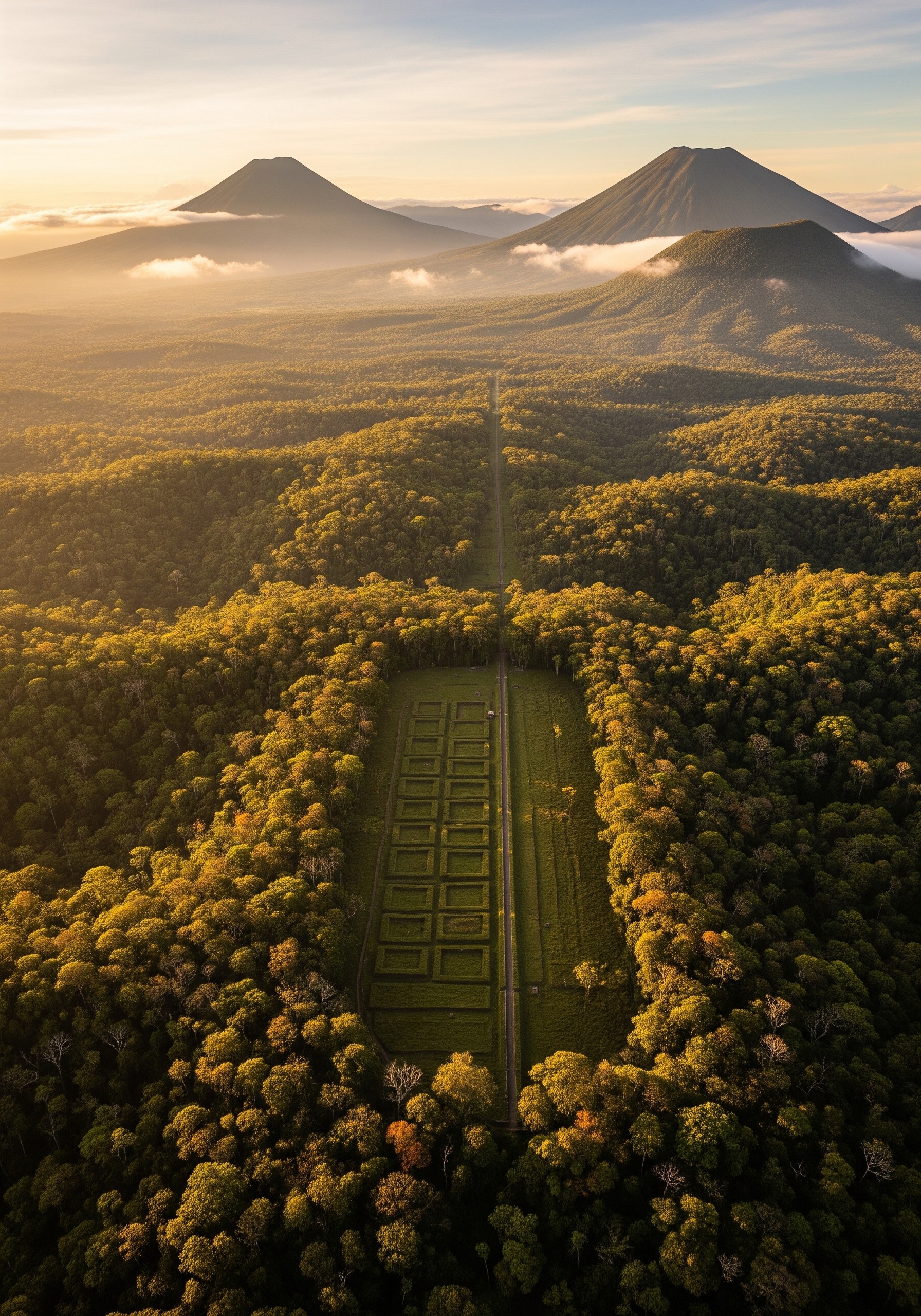
The results have been quietly seismic. In Guatemala’s Petén jungle, a 2018 LIDAR survey mapped more than 60,000 previously unknown Maya structures — pyramids, palaces, causeways, and defensive walls — across an area twice the size of Greater London. In 2024, a research team led by Luke Auld-Thomas of Tulane University reanalysed a 2013 LIDAR dataset originally flown to monitor Mexican forest carbon and identified a full city, Valeriana, that had been sitting in the data unread. The team’s results were published in Antiquity, the Cambridge University Press archaeology journal.
“The government never knew about it; the scientific community never knew about it,” Auld-Thomas told reporters at the time. The implication is sobering: how many other cities are already inside our hard drives, waiting for someone to look?
{IMAGE_2}
Valeriana (2024): A Maya City Hidden in Plain Sight
Valeriana — named after a nearby lagoon, not an ancient ruler — sits in the southern Mexican state of Campeche. Surveying about 50 square miles, Auld-Thomas and his Tulane colleagues, including Professor Marcello Canuto of the Middle American Research Institute, counted 6,764 structures. The city itself has all the hallmarks of a Classic Period (roughly AD 250–900) Maya political centre: multiple enclosed plazas, temple pyramids, a ballcourt, a dammed reservoir, and a curved amphitheatre. At its peak it likely housed tens of thousands of people.
The most extraordinary detail is its location. Valeriana lies a short distance from a modern highway and is partly overlaid by present-day villages. People have lived on top of it, driven past it, and farmed its outskirts for generations. Without LIDAR, it might have stayed invisible for another century.
The Upano Valley: 2,500-Year-Old Cities in the Ecuadorian Amazon
If Valeriana rewrites our map of the Maya world, the Upano Valley rewrites our map of the Amazon. In January 2024, archaeologist Stéphen Rostain of France’s CNRS (National Centre for Scientific Research) and his colleagues published a LIDAR survey in Science covering roughly 300 square kilometres of Ecuador’s eastern Andean foothills. The data revealed more than 6,000 rectangular earthen platforms grouped into at least 15 distinct urban centres, linked by wide, straight roads with right-angle junctions — the visible plumbing of a real civilisation.
These settlements were first occupied around 500 BC and were apparently abandoned between roughly AD 300 and 600. That makes them older than most known complex Amazonian societies by more than a thousand years, and contemporary with the Roman Republic. The implication, long resisted by Western archaeology, is now hard to escape: the Amazon was never an “empty” rainforest. It was, in many places, a managed garden surrounding densely populated cities — closer in scale to Bronze-Age Europe than to anything the conquistadors expected to find.
Rediscovered vs. Discovered: A Distinction That Matters
Popular lists collapse two very different categories into one. Most of the famous “lost cities” of the ancient world were never lost to the people who lived near them — only to outsiders. Petra, carved into the rose-red sandstone of southern Jordan and once the capital of the Nabataean trade empire, was continuously known to local Bedouin when the Swiss explorer Johann Ludwig Burckhardt was guided there in 1812. Machu Picchu, the Inca royal estate perched 7,900 feet up in the Peruvian Andes, was being farmed by local families when Hiram Bingham reached it in 1911 and published it in National Geographic in 1913. Troy was identified at the mound of Hisarlik in modern Turkey by Heinrich Schliemann in the 1870s, but it had never stopped being a real place.
The cities being uncovered today — Valeriana, the Upano settlements, fortified Portuguese-era complexes spotted by LIDAR in Brazil — belong to a different category. They were forgotten by everyone, including the descendants of those who built them. Many vanished after collapses or migrations whose causes we are only beginning to understand, and which sometimes mirror the disappearance of the lost people of the Green Sahara — entire populations dissolved by climate or violence and erased from genetic memory.
The Scale of What We Did Not Know
- 60,000+ Maya structures mapped in one Guatemalan LIDAR survey (PACUNAM, 2018).
- 6,764 structures counted at Valeriana and its surrounds (Auld-Thomas et al., 2024).
- 15 linked urban centres in Ecuador’s Upano Valley, occupied from c. 500 BC.
- 10,000–24,000 estimated pre-Columbian earthworks across the Amazon basin.
- ~650 m depth of geometric formations off Cuba’s coast — still debated, not yet confirmed.
Cities We Still Cannot Find
For every Valeriana, there is an Akkad. The capital of the world’s first known empire — Sargon of Akkad’s, around 2350–2150 BC — is mentioned in cuneiform tablets, listed in king-lists, and stamped on victory steles. We still have no idea where it stood. It is somewhere in modern Iraq, probably along the Tigris, and yet a century of survey has failed to fix it on a map. The same is true of Itjtawy, the Middle Kingdom Egyptian capital founded around 1981 BC, and of Thinis, the prehistoric seat from which the first pharaohs are said to have unified Egypt. These cities are not myths. We have their tax records. We just cannot find them.
The reason is usually mundane: river silt. Mesopotamian and Egyptian capitals were almost always built on or near major rivers, which over four or five millennia have shifted course many times, burying entire urban footprints under 10 or 20 metres of alluvial mud. LIDAR cannot see through that. Ground-penetrating radar can, but slowly, and only where surveyors are allowed to walk — which in much of the Middle East today they are not.
A Timeline of Rediscoveries: How Technology Changed the Map
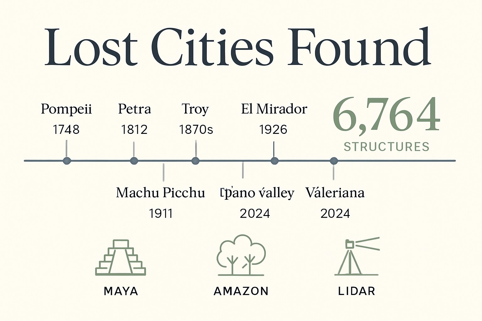
The pattern of who finds what, and when, follows the tools available. The 19th century belonged to literary readers like Schliemann, who used Homer as a treasure map. The 20th century belonged to aerial photographers, then to satellite radar. The 21st century belongs to LIDAR — and, increasingly, to people willing to look again at data someone else collected.
| City | Year Revealed | How Found | Status |
|---|---|---|---|
| Pompeii | 1748 | Accidental well-digging | Buried by Vesuvius, AD 79 |
| Petra | 1812 | Burckhardt, guided by Bedouin | Locally known throughout |
| Troy (Hisarlik) | 1870s | Schliemann, reading Homer | Site identified, still excavated |
| Machu Picchu | 1911 | Bingham, guided by farmer | Locally known throughout |
| El Mirador (Maya) | 1926 / LIDAR 2018 | Aerial survey, then LIDAR | 60,000+ new structures mapped |
| Upano Valley | 2024 (publ.) | LIDAR (Rostain et al.) | 15 linked Amazonian cities |
| Valeriana | 2024 | Reanalysed 2013 LIDAR data | Maya political centre |
| Akkad | — | Unknown | Still entirely lost |
What This Means for the Decade Ahead
The professional consensus among Maya specialists is now blunt: we have not catalogued most of the cities that exist. Tulane’s research team has argued in print that “we have not found all the major Maya cities — not even close.” The same goes for the Amazon, where Stéphen Rostain has spent thirty years arguing that the rainforest hides a lost urban civilisation comparable in complexity to anything in the Old World. He is now being proven right.
The next wave of discoveries will probably not come from new expeditions. It will come from re-reading data that already exists — environmental surveys, forestry LIDAR flights, satellite-radar archives, even high-resolution Google Earth tiles. The most exciting tool in archaeology in 2026 may not be a drone or a laser. It may be a graduate student with patience, a fast laptop, and a hunch.
Frequently Asked Questions
Q: How many lost cities of the ancient world have been discovered so far?
A: There is no single official count. Hundreds of substantial ancient cities have been excavated worldwide, and thousands more settlement-scale sites have been mapped — but in regions like the Maya lowlands and the Amazon, recent LIDAR work has revealed that the visible total may represent only a small fraction of what was actually built.
Q: What is the most recent lost city to be discovered?
A: Among formally published finds, two stand out: Valeriana, a Classic-Period Maya city in Campeche, Mexico, identified from LIDAR data in 2024 by a Tulane University team; and the Upano Valley urban system in Ecuador, published in Science the same year, showing at least 15 linked Amazonian cities dating back to 500 BC.
Q: Why are so many ancient cities still being found in 2024–2026?
A: Airborne LIDAR can now strip away rainforest canopy and reveal the bare-earth shape of buried streets and pyramids in a single flight. Many recent discoveries also come from re-analysing older LIDAR or satellite datasets originally collected for forestry or environmental monitoring, not archaeology.
Q: What ancient cities are still lost today?
A: At least six well-attested ancient capitals remain unlocated, including Akkad (Sargon’s capital, c. 2350 BC), Itjtawy (Middle Kingdom Egypt), Thinis (proto-dynastic Egypt), Waššukanni (Mitanni capital), Irisagrig (Sumerian), and the Babylonian-exile community of Al-Yahudu. All are named in surviving texts, none has been found on the ground.
Sources
- Rostain et al., “Two thousand years of garden urbanism in the Upper Amazon,” Science (2024)
- Tulane University News — “Have we recovered all the major Maya cities? Not even close” (2024)
- Smithsonian Magazine — “Ancient Cities Hidden in the Ecuadorean Amazon”
- Live Science — “6 lost cities archaeologists have never found”
- Wikipedia — Upano Valley sites (overview and bibliography)
The lost cities of the ancient world are not a closed chapter. They are an open one — being rewritten, season by season, by archaeologists who have learned that the most useful expedition of all may be the one back through somebody else’s data. Somewhere, on a hard drive in Mexico City or Quito or Cambridge, the next great find is already there, waiting for someone to recognise the shape of a pyramid in the shadows.
Illustrations are AI-generated. Article fact-checked and human-edited.