How Drones Detect Illegal Logging in Sumatra
How drones detect illegal logging in Sumatra begins not with a chainsaw but with a conversation. Zurich, January 2011: an ecologist named Lian Pin Koh and a primatologist named Serge Wich were talking about a problem neither could solve alone. Wich needed to count Sumatran orangutans across a rainforest too vast and too broken to walk. Koh, then at ETH Zurich, had been tinkering with hobby aircraft. What if, they asked, a cheap model airplane could fly the forest for them — and photograph what the loggers below did not want anyone to see?
Key Facts
- The idea was sparked in January 2011 in Zurich by ecologist Lian Pin Koh and primatologist Serge Wich.
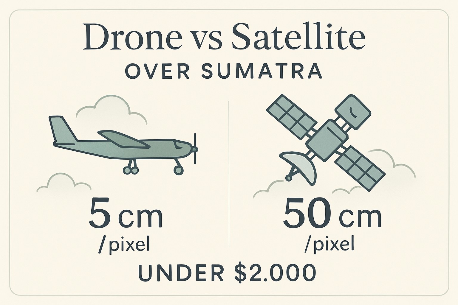
- The first prototype, a Hobbyking Bixler foam plane with an open-source autopilot, cost under $2,000, versus about $50,000 for commercial UAVs.
- It flew 32 missions near Gunung Leuser between 13 and 16 February 2012; the findings appeared in Tropical Conservation Science under the title Dawn of Drone Ecology.
- Drone imagery runs about 5 cm per pixel versus roughly 50 cm for the Pleiades-1B satellite, lifting land-cover accuracy to about 94% versus 72%.
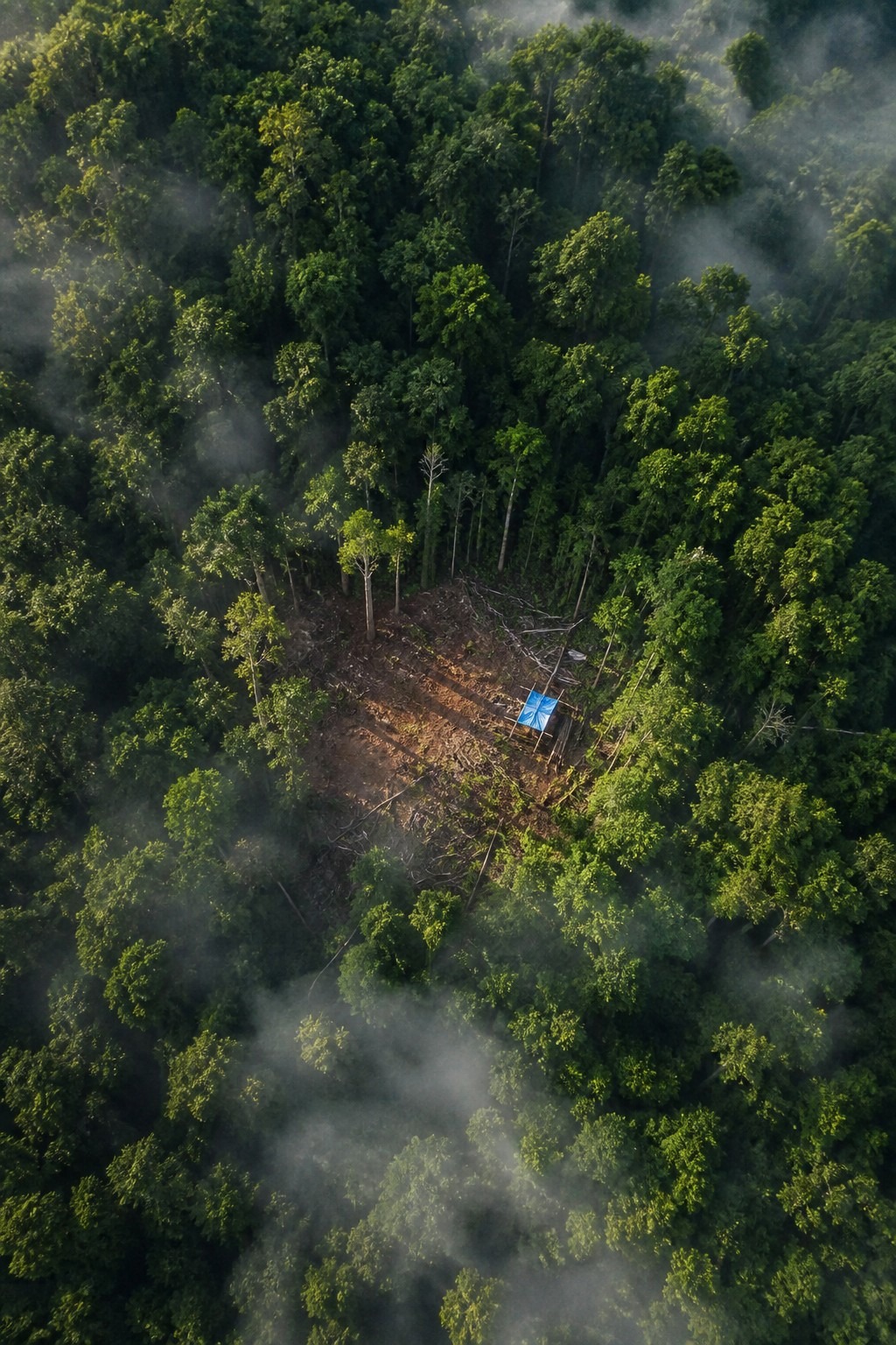
- Blue or orange tarpaulins over illegal camps are a key visual giveaway against the green canopy.
In short: Conservation drones detect illegal logging in Sumatra by flying cheap camera-equipped foam planes below the clouds to capture roughly 5 cm/pixel imagery, ten times sharper than satellites. The idea began in Zurich in 2011; a sub-$2,000 prototype flew 32 missions near Gunung Leuser in 2012, spotting camps by their blue tarps.
How Drones Detect Illegal Logging in Sumatra: The Idea That Started in Zurich
The scale of the problem is what made the idea necessary. A full distribution survey of Sumatra’s orangutans — teams walking transects, counting nests by hand — had reportedly taken about two and a half years and roughly $250,000. That is a quarter of a million dollars and half a decade of careers to map a population that was disappearing faster than anyone could count it.
Koh and Wich wanted the same coverage in an afternoon. Their answer was almost insultingly simple: strap a small camera and an autopilot to a foam model plane, load a flight path drawn on Google Earth, and let it fly itself over the canopy. No pilot. No aircraft rental. No permission required from the men with the chainsaws.
The detection method that grew out of that conversation is, at its core, a matter of resolution and timing. A drone flies low, under the clouds, on demand — and it brings back pictures sharp enough to read the forest floor. Everything else follows from those two facts.
- January 2011 — Koh and Wich meet in Zurich and sketch the idea.
- 13–16 February 2012 — First prototype flies 32 missions near Gunung Leuser, North Sumatra.
- 2014 — Conservation drones photograph active illegal logging camps inside Gunung Leuser.
- October 2024 — A peer-reviewed study pairs chainsaw-audio sensors with auto-dispatched drones.
- 2025 — Reporting confirms Indonesia’s deforestation rose for a third straight year.
February 2012: The $2,000 Plane That Did a $50,000 Job
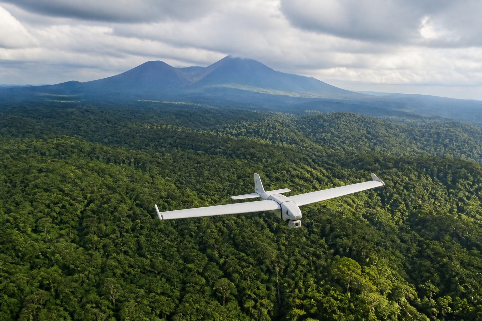
The first prototype was not glamorous. Its airframe was a Hobbyking Bixler — a foam model plane you could buy for under $100 — fitted with an open-source autopilot, a GPS unit, and a small camera. The whole rig came in under $2,000. Commercial conservation UAVs at the time ran closer to $50,000. Koh and Wich had built something roughly twenty-five times cheaper, and they had built it to be rebuilt by anyone with a soldering iron and a weekend.
Between 13 and 16 February 2012, they flew it. Thirty-two missions over the forest bordering Gunung Leuser National Park, each flight pre-programmed from waypoints dropped on Google Earth. The original plane stayed aloft for about 25 minutes and covered roughly 15 kilometres per sortie — modest numbers that later, refined models pushed toward 50-minute flights and 25 kilometres of range. It launched from a hand-throw and landed itself on a belly of foam.
Here’s the thing about that price tag: it changed who got to watch the forest. A $50,000 system is a research grant. A $2,000 system is a tool a park office can own, crash, and replace. The findings were published that year by Koh and Wich in the journal Tropical Conservation Science, under a title that turned out to be accurate — “Dawn of Drone Ecology.”
{IMAGE_2}
What the Camera Saw That the Satellite Couldn’t
Satellites already watched Sumatra from orbit, so why send up a foam plane at all? Three reasons, and the first is the sky itself. Sumatra spends much of the year under thick tropical cloud. Optical satellites cannot see through cloud; they wait for a clear pass that may not come for weeks. A drone simply flies beneath the weather.
The second reason is sharpness. Remote-sensing comparisons of UAV imagery against high-resolution satellites like Pleiades-1B put the drone at roughly 5 centimetres per pixel against the satellite’s 50 centimetres — a tenfold jump in detail. At that resolution, automated classification of what’s actually on the ground climbs dramatically; studies comparing the two have reported land-cover accuracy near 94 percent for drone imagery versus about 72 percent for the coarser satellite data. Fifty centimetres per pixel tells you the forest is gone. Five centimetres tells you the stumps are fresh, the track is new, and a tarp is stretched between two trees.
The third reason is timing. A satellite passes when its orbit says so. A drone goes up when a ranger has a hunch. That difference — watching on demand rather than on schedule — is what turns a picture into evidence.
What comes back from a flight is not one photograph but hundreds of overlapping frames. Software stitches them into a single seamless map — an orthomosaic, in the jargon — where every pixel sits at its true position, so a suspicious clearing can be measured, dated against last month’s flight, and pinned to exact GPS coordinates. That is the quiet part of how drones detect illegal logging in Sumatra: not just seeing the damage, but locating it precisely enough that someone can be sent to the spot.
The Blue Tarp Rule, and the Curtain of Trees Along the River
Once the images come back, detection becomes a reading exercise, and the loggers hand you the clues. An illegal camp needs shelter, and shelter in the rainforest means a tarpaulin — almost always blue or orange. Against an unbroken green canopy, that saturated blue is a pixel-level confession. Rangers learned to scan for it; today, computer-vision models are trained to flag the same colour signature automatically. Nature does not make that blue. Only a camp does.
The most cinematic proof came in 2014. Drone specialist Graham Usher, working with the Sumatran Orangutan Conservation Programme, described footage from Gunung Leuser that exposed a trick the loggers had grown confident using. From the river, and from a satellite pass, the forest along the bank looked intact — a solid green wall. The cutters had deliberately left a thin curtain of trees standing along the waterline. Behind that curtain, invisible from boat patrols and orbit alike, was a clear-cut. Only the drone, looking straight down, saw through the disguise.
That single frame is the whole argument for flying low. A concealment strip works against every observer at ground level or in space. It does not work against a camera directly overhead.
2024: The Year the Numbers Got Worse
More than a decade after that first flight, the forest the drones were built to defend is still shrinking — and faster. According to a report from the Indonesian NGO Auriga Nusantara, widely reported by Mongabay in early 2025, Indonesia lost 261,575 hectares of forest in 2024. That was the third consecutive annual rise, and the highest figure in several years. Uncomfortably, most of that clearing in 2024 was legal — permitted land conversion for palm oil, pulpwood, and mining — not the illegal cutting a drone is meant to catch.
Sumatra took a heavy share. Estimates of the island’s 2024 loss range from around 78,000 hectares in one tally to higher figures in others, with the provinces of Riau (about 29,700 hectares) and Aceh (about 11,200 hectares) leading. Inside Gunung Leuser National Park itself, the cleared area was far smaller — reported at roughly 475 acres, about 190 hectares — a reminder that the drones, the rangers, and the park’s protected status do hold a line, even as the wider landscape erodes around it.
The uncomfortable truth is that the drone never stopped a single chainsaw; it only made the cutting impossible to deny. Detection is not deterrence, and a photograph is only as powerful as the law enforcement willing to act on it. In Sumatra, that footage is handed to park rangers and Indonesian authorities, who decide what happens next.
The Chainsaw That Calls a Drone
So detection is moving upstream — from “photograph the damage” to “hear the cut as it starts.” A 2024 study published in Elsevier’s journal Internet of Things describes the shape of it: small acoustic sensors, scattered through the forest, listening for one specific sound. A neural network trained on chainsaw audio reportedly identified the noise with 99.37 percent accuracy, at ranges up to 100 metres, on nodes designed to run for years on a single battery.
The clever part is what happens next. The sensors talk over LoRaWAN — a low-power, long-range radio network — so that the instant a chainsaw fires up, the system can dispatch a camera drone toward the coordinates, stream the footage to a cloud model for confirmation, and in some designs trigger light or sound deterrents on the spot. The forest, in effect, gains a nervous system: an ear that hears the cut and a wing that flies to look.
It is early, and a lab accuracy figure is not the same as a rainforest full of rain, insects, and interference. A sensor that scores 99 percent on clean recordings still has to survive humidity, monkeys, and the sheer ambient noise of a living forest — and a 100-metre listening radius means a lot of ground still goes unheard between nodes. But the direction is clear. The 2012 drone answered the question “what was cut, and where?” The 2024 system tries to answer a harder one: “is a tree being cut right now?”
Where It Stands for the Last Orangutans
All of this exists for an animal. Gunung Leuser is the heart of the Leuser Ecosystem, and it is the single most important refuge for the critically endangered Sumatran orangutan. Estimates of the wild population vary widely — often cited between about 6,600 and 14,000 — but the consensus is stark: the great majority depend on this one landscape, with roughly 5,000 living in and around Leuser and something like 85 percent of the species tied to it. Lose Leuser and you lose the orangutan.
That is why a foam plane costing less than a used phone still matters. What Koh and Wich built in 2012 did not save the forest by itself, and no one honest ever claimed it would. What it did was cheaper and quieter and more durable than a rescue: it removed the excuse of not knowing. A curtain of trees along a river can fool a boat. It cannot fool a camera looking straight down — and now, increasingly, it cannot outrun a sensor that hears the saw before the first tree falls.
Quick Answers
Who invented conservation drones for Sumatra? Ecologist Lian Pin Koh (then at ETH Zurich) and primatologist Serge Wich, who met in Zurich in January 2011 and flew their first prototype near Gunung Leuser in February 2012.
Why use drones instead of satellites? Drones fly under Sumatra’s near-constant cloud cover, capture roughly ten times sharper imagery (about 5 cm per pixel), and can be launched on demand rather than waiting for a satellite pass.
Sources and Notes
- Koh, L.P. & Wich, S.A. (2012). “Dawn of Drone Ecology: Low-Cost Autonomous Aerial Vehicles for Conservation.” Tropical Conservation Science 5(2):121–132.
- Sumatran Orangutan Conservation Programme / ConservationDrones.org — field reporting by drone specialist Graham Usher on illegal logging detected in Gunung Leuser (2014).
- Study on AI-IoT and UAV systems for real-time illegal-logging detection, Internet of Things (Elsevier), 2024.
- Auriga Nusantara 2024 deforestation report, as reported by Mongabay and France 24 (early 2025).
- Global Forest Watch and Katadata/Databoks summaries of Sumatra provincial forest-loss figures for 2024.
A decade on, the conservation drone has stopped being a novelty and become plumbing — one more instrument in a park office, alongside the maps and the radios. Its real legacy is not a gadget but a principle: that the cheapest way to protect a rainforest may simply be to make it impossible to cut one down unseen.
Frequently Asked Questions
Q: How do drones detect illegal logging in Sumatra?
They fly low, on demand, and under the cloud that blinds satellites, bringing back imagery around 5 centimetres per pixel, sharp enough to read the forest floor. Software stitches hundreds of frames into a georeferenced orthomosaic, so a fresh clearing or camp can be measured, dated against last month’s flight, and pinned to exact GPS coordinates for a ranger to visit.
Q: How did the drone idea start?
In January 2011, ecologist Lian Pin Koh and primatologist Serge Wich met in Zurich. Wich needed to count Sumatran orangutans across a forest too vast to walk; an earlier survey had reportedly taken about 2.5 years and $250,000. They decided to strap a camera and an autopilot to a foam model plane and let it fly a path drawn on Google Earth over the canopy.
Q: Why use drones instead of satellites?
Three reasons. Sumatra is often under thick tropical cloud that optical satellites cannot see through, while a drone flies beneath the weather. Drone imagery is far sharper, about 5 cm per pixel versus 50 cm for satellites like Pleiades-1B, pushing automated land-cover accuracy to about 94% versus 72%. And a drone goes up when a ranger has a hunch, not when an orbit allows.
Q: How cheap was the first conservation drone?
The first prototype used a Hobbyking Bixler foam plane, buyable for under $100, fitted with an open-source autopilot, GPS and a small camera, for under $2,000 in total. Commercial conservation UAVs then cost closer to $50,000, so the rig was roughly twenty-five times cheaper and could be crashed and rebuilt by a park office with a soldering iron.
Illustrations are AI-generated. Article fact-checked and human-edited. Our editorial standards.