Lightning at Moro Rock: The 1975 Photo That Haunts Sequoia
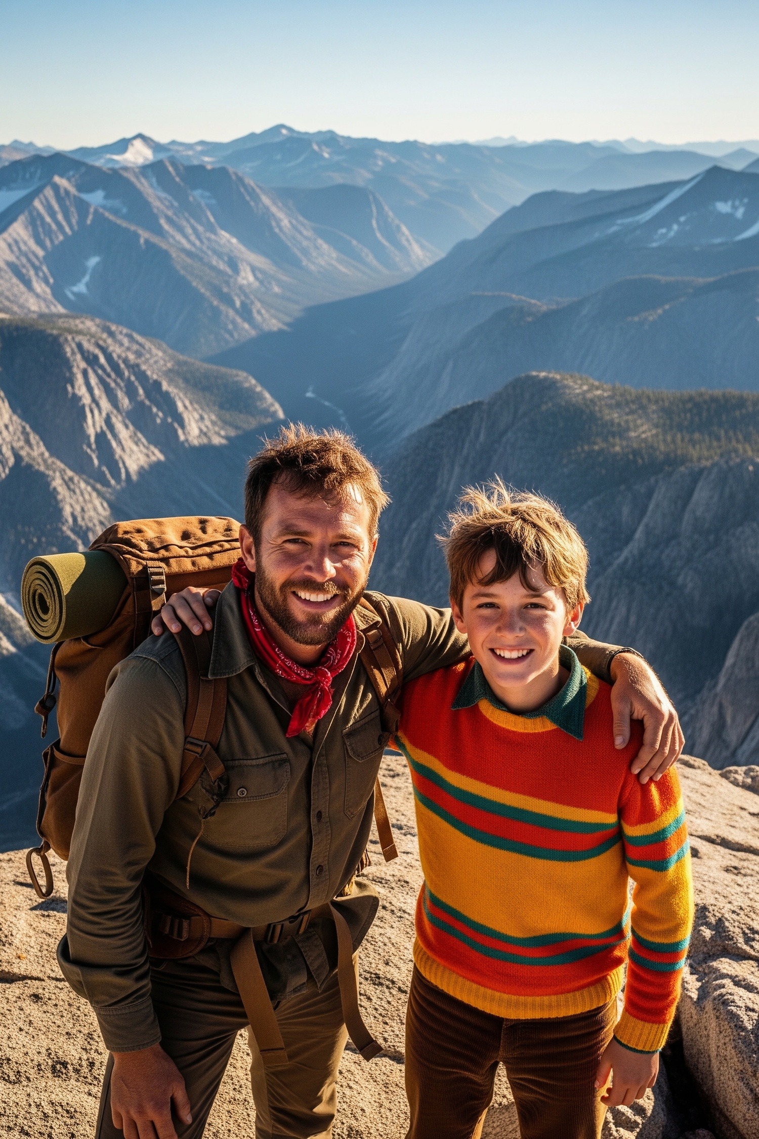
A photograph exists somewhere in the institutional memory of American hiking — two brothers grinning at a camera, granite behind them, the sky deceptively blue. Minutes after that shutter clicked, the Moro Rock lightning strike of 1975 arrived without warning. No one taught them to read the silence before a storm. For nearly fifty years, this image has circulated through climbing forums and ranger briefing rooms as evidence of something we still don’t quite understand: why proximity to danger doesn’t reliably create distance from it.
Moro Rock rises to 6,725 feet above California’s Sierra Nevada, a bare granite dome with no shelter and almost no margin for error. In the summer of 1975, two brothers stood near its summit for a snapshot. Minutes after the shutter clicked, a fast-moving thunderstorm arrived without ceremony. Both men survived. A nearby hiker did not.
The photo, which has circulated across hiking communities and lightning safety forums ever since, raises a question that still doesn’t have a clean answer: what does it take to make people leave?
Key Facts
- Moro Rock rises to 6,725 feet above Sequoia National Park’s Giant Forest, a bare granite dome well above the treeline.
- In summer 1975, two brothers were photographed near the summit moments before a thunderstorm; both survived but a nearby hiker was killed.
- Cumulonimbus clouds can develop from first formation to full storm height in about 40 minutes over Sierra Nevada terrain on summer afternoons.
- Ground current from a lightning strike can cause serious injury or death up to 15 feet away, even without a direct hit.
- At least 11 lightning incidents were documented on exposed Sequoia and Kings Canyon summits between 1960 and 1990, with Moro Rock appearing multiple times (NPS files).
In short: The Moro Rock lightning strike of 1975 killed a hiker and injured two brothers photographed near the summit moments before a fast-moving thunderstorm hit the 6,725-foot exposed granite dome. The widely circulated photograph endures as a warning about how quickly storms build at elevation and how rarely danger looks like danger.
Exposed Granite and the Physics of Being a Target
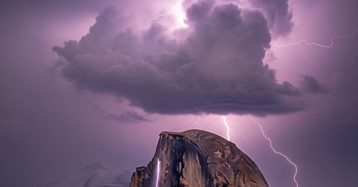
Rising dramatically above Sequoia National Park’s Giant Forest, Moro Rock is a geometry lesson in why elevation and isolation kill. This exfoliated granite dome sits well above the treeline, jutting into open atmosphere with no neighboring ridge, no tall trees, and no topographic shelter to redirect electrical charge. According to the physics of lightning strike formation, tall, isolated, and electrically conductive objects standing proud of surrounding terrain attract stepped leaders — the invisible downward channels of charge that precede a bolt. Moro Rock checks every box.
The National Park Service documented repeated lightning incidents on and around the dome through the 1970s and 1980s, and park rangers began issuing formal visitor warnings about the summit’s exposure as early as 1968. By 1975, the danger was not a secret.
What makes summer afternoons at Moro Rock so consistently dangerous is the Sierra Nevada’s convective weather pattern. Moist air from the Pacific pushes inland and rises sharply against the mountains. By early afternoon, cumulonimbus towers build faster than most visitors expect — sometimes reaching full storm height within forty minutes of first formation. The rock’s summit, sitting at 6,725 feet with a 360-degree exposure to open sky, becomes both an antenna and a stage. Rangers have noted for decades that the storms often look distant until they’re directly overhead.
There’s also the rock’s surface to consider.
Wet granite conducts electricity with brutal efficiency. A strike doesn’t have to hit you directly. Ground current radiating outward from the point of contact can be lethal at fifteen feet. The dome offers no crevice deep enough, no overhang wide enough. If you’re on it when lightning arrives, you’re in it.
The Photograph as Evidence
Photographs taken at high-altitude viewpoints carry a strange double life. In the moment, they’re proof of arrival — evidence that you stood somewhere remarkable and looked out. Both brothers were day visitors to Sequoia National Park, hiking one of the Sierra Nevada’s most accessible summit trails — a paved, quarter-mile path that switchbacks up from the parking area below. The trail draws thousands of visitors every summer, many of whom have never thought seriously about lightning risk at altitude.
In retrospect, some images become documents of the last normal second before something changed.
The 1975 Moro Rock photograph belongs to a specific and unsettling category where joy is visible and danger is not. Here’s the thing: there’s a parallel to how certain natural phenomena hide their urgency — much like the ancient oak ecosystems described in how a single oak tree sustains a hidden world of interdependence — where the surface calm masks something far more complex and consequential beneath.
What Happened in the Minutes After
The storm was fast. Visitors on an exposed summit rarely have the fifteen minutes that safety guidelines assume. What happened in the minutes after the photograph was taken follows the pattern that Sequoia rangers and lightning researchers have reconstructed from dozens of similar incidents — the brothers were struck before they could complete their descent. One sustained significant injuries — burns, temporary loss of consciousness, and nerve damage that persisted for years. The other was injured but recovered more quickly. The hiker struck nearby died at the scene.
Emergency response in the backcountry was slower and more complicated in 1975 than it is today, and the remote location of the trail added critical minutes to evacuation time. Park staff who responded later described the aftermath on the rock’s surface: the smell of ozone, scorch marks on the granite, and the eerie silence that follows a strike in an open landscape. Nothing dramatic. Just the mountain, unmoved, and three people on it changed forever.
How Lightning Reshapes Risk Calculation
The Sierra Nevada sees some of California’s most intense summer lightning activity, and Moro Rock isn’t the only peak with a documented injury history. But it has become the most symbolically loaded site in the range’s lightning record, partly because of the 1975 photograph and partly because of the rock’s architectural drama — the dome shape, the 270-degree panoramic views, the way visitors feel simultaneously triumphant and exposed at the top.
Why does this matter? Because National Geographic’s research on lightning behavior confirms that open, elevated terrain in mountainous regions generates disproportionately high strike densities compared to lower elevations, and that granite formations in particular create surface conditions that amplify ground current risk.
Between 1960 and 1990, Sequoia and Kings Canyon National Parks recorded at least eleven lightning-related incidents on exposed summits, with Moro Rock appearing in the record multiple times. What’s counterintuitive about the 1975 strike, and about lightning incidents at high-altitude viewpoints generally, is that most victims are not reckless or uninformed. Studies conducted by the National Oceanic and Atmospheric Administration between 2006 and 2019 found that the majority of lightning fatalities in the American West occurred on days with partly cloudy skies — not the dramatically dark skies most people associate with danger. The storm arrives before the visual cue arrives.
Watching a species of person — the hiker, the observer, the one who lingers — get struck down at this speed, you stop calling it a coincidence.
Visitors on Moro Rock that summer day in 1975 likely saw blue sky above them longer than they should have trusted it. That mismatch between perceived and actual risk is what makes the photograph so haunting. The sky in the frame is bright. The granite is warm. The brothers are smiling. The photograph is lying, in the way that all still images lie — it freezes a moment and erases the direction of time.
What Changed After 1975
In the years following the incident, the National Park Service revised and expanded its lightning safety protocols at Sequoia in ways that directly referenced the Moro Rock exposures. The park installed additional warning signage at the trailhead and at the summit, updated ranger briefing materials to include specific language about afternoon convective storms, and began coordinating with the National Weather Service’s Hanford, California office to monitor storm development over the Sierra Nevada during peak season.
A 1978 internal NPS safety review, conducted after a cluster of lightning incidents across multiple western parks, identified Moro Rock as a high-priority site for visitor education intervention. That review led to the placement of lightning detection equipment in the Giant Forest area and to a formal policy requiring rangers to radio summit visitors when storm cells were tracked within fifteen miles. The cause-and-effect chain is instructive: a photograph is taken, lightning strikes, a hiker dies, an internal review happens, equipment is installed, a policy is written.
It looks like progress, and it is — but the underlying physics don’t change. Moro Rock is still 6,725 feet of exposed granite jutting into a sky that builds thunderstorms in forty minutes or less on summer afternoons. The 2020s version of the summit warning signs uses more urgent language and larger type than the signs from 1975.
And yet the dome remains unchanged. Park rangers at Sequoia now conduct what they call proactive summit clearances — descending the trail themselves and physically encouraging visitors to leave when storm conditions are detected, rather than relying solely on signage. It’s a meaningful change. Rangers from the Sequoia and Kings Canyon Interpretive Division reported in 2022 that visitor compliance during active weather advisories had improved substantially since the practice began in the 2000s. Bodies in motion respond to people, not signs. That’s a lesson the 1975 photograph teaches without a single word.
Where to See This
- Moro Rock, Sequoia National Park, California, USA — accessible via a quarter-mile paved trail from Moro Rock Road; best visited in morning hours during summer (June–August) to minimize afternoon thunderstorm exposure; the park recommends arriving at the summit before 11 a.m. during monsoon season.
- The National Weather Service’s Hanford, California forecast office (weather.gov/hnx) publishes daily lightning risk outlooks for the Sierra Nevada and provides the storm-tracking data Sequoia rangers use to make summit clearance decisions.
- The National Park Service’s lightning safety page (nps.gov/articles/lightning-safety) includes a specific section on elevated viewpoints and provides the thirty-minute rule: if you can hear thunder, you should already be off an exposed summit and moving to lower terrain.
By the Numbers
- 6,725 feet — the summit elevation of Moro Rock, placing it well above the surrounding forest canopy and into the zone of maximum convective storm exposure during Sierra Nevada summers.
- Approximately 2,000 lightning fatalities occur in the United States each decade, with the American West and mountain regions accounting for a disproportionate share (NOAA Lightning Safety Council, 2021).
- Forty minutes — the approximate time it can take a cumulonimbus cloud to develop from first formation to full storm height over Sierra Nevada terrain on a summer afternoon.
- Fifteen feet — the distance at which ground current from a lightning strike can still cause serious injury or death, even without a direct hit to the body.
- Eleven documented lightning incidents on exposed Sequoia and Kings Canyon summits between 1960 and 1990, with Moro Rock appearing in the record on multiple occasions according to NPS historical safety files.
Field Notes
- In 1983, a ranger stationed at Sequoia’s Giant Forest documented a strike on Moro Rock’s eastern face that left a visible ablation scar on the granite surface — a fused, glassy channel nearly three meters long where the rock itself had partially vaporized. The scar remained visible for more than a decade before erosion and weathering obscured it.
- Most people assume lightning strikes the highest point on a landscape. In reality, stepped leaders can attach to any object that provides a viable conductive path — meaning a person standing ten feet lower than a summit cairn is not meaningfully safer than one standing at the top (and this matters more than it sounds).
- The 1975 photograph’s circulation through hiking communities predates the internet — it was passed between Sierra Club chapters and wilderness safety courses as a physical print before it ever appeared online, giving it an unusual analog provenance that most viral safety images lack.
- Researchers at the University of Florida’s International Center for Lightning Research and Testing still can’t reliably predict which specific object within a cluster of potential strike targets will be chosen by a given leader channel — the selection process involves variables at the molecular scale of air ionization that remain imperfectly modeled even in 2024.
Frequently Asked Questions
Q: What exactly happened during the Moro Rock lightning strike of 1975?
In the summer of 1975, two brothers were photographed near the summit of Moro Rock in Sequoia National Park moments before a fast-moving thunderstorm arrived. Lightning struck before they could descend. Both brothers survived — one with significant injuries including burns and nerve damage — but a hiker nearby was killed at the scene. The photograph taken just before the strike has circulated through hiking and lightning safety communities for nearly fifty years as a sobering illustration of how quickly conditions can change at elevation.
Q: Why is Moro Rock so dangerous during thunderstorms?
Moro Rock’s danger comes from its geometry and isolation. At 6,725 feet, the bare granite dome sits well above the treeline with no neighboring ridgeline, no tall vegetation, and no topographic shelter. It’s an electrically isolated, elevated mass of conductive rock exposed on all sides to open sky — exactly the conditions that attract lightning stepped leaders. Compounding this, Sierra Nevada thunderstorms in summer can develop from clear sky to full storm in under an hour, giving visitors on the summit very little warning time before conditions become life-threatening.
Q: Is it safe to visit Moro Rock today, and what precautions should hikers take?
Moro Rock is safe to visit under the right conditions, but those conditions require active attention. The National Park Service recommends hiking the summit trail in the morning, before midday convective heating begins building afternoon storms. Visitors should check the National Weather Service forecast for the Sierra Nevada before departing and should leave the summit immediately at the first sound of thunder — not when lightning is visible, but when thunder is audible. Rangers at Sequoia conduct proactive clearances during active weather advisories, but compliance remains every hiker’s personal responsibility.
Editor’s Take — Sarah Blake
What unsettles me most about this story isn’t the lightning. It’s the photograph. We’ve developed an entire cultural vocabulary around images that capture the moment before disaster — and yet that vocabulary hasn’t made us meaningfully faster at leaving exposed summits when the sky begins to change. The 1975 photograph has been in circulation for nearly fifty years. Moro Rock’s warning signs have been updated multiple times. Rangers now walk the trail themselves to move people off. And still, every summer, visitors linger at the top and watch the clouds build.
The granite dome hasn’t changed by a single molecule since that day in 1975 — the trail is still a quarter mile, the summit still fully exposed, the Sierra Nevada still building thunderstorms in forty minutes on a warm afternoon. What has changed is how much we know about stepped leaders, about ground current, about the mismatch between perceived and actual risk at elevation. The question that the photograph keeps asking, quietly, across five decades, is whether knowing is ever actually enough to make us move.
Illustrations are AI-generated. Article fact-checked and human-edited. Our editorial standards.